You are here: Home > Network List > US - United States National Seismic Network Stations List
> Station MSO Missoula, Montana, USA > Earthquake Result Viewer
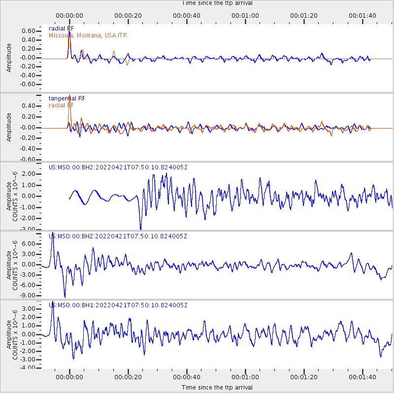
MSO Missoula, Montana, USA - Earthquake Result Viewer
*The percent match for this event was below the threshold and hence no stack was calculated.
| Earthquake location: |
Near Coast Of Nicaragua |
| Earthquake latitude/longitude: |
11.5/-87.0 |
| Earthquake time(UTC): |
2022/04/21 (111) 07:42:51 GMT |
| Earthquake Depth: |
10 km |
| Earthquake Magnitude: |
6.8 Mi |
| Earthquake Catalog/Contributor: |
NEIC PDE/at |
|
| Network: |
US United States National Seismic Network |
| Station: |
MSO Missoula, Montana, USA |
| Lat/Lon: |
46.83 N/113.94 W |
| Elevation: |
1264 m |
|
| Distance: |
41.9 deg |
| Az: |
332.254 deg |
| Baz: |
138.348 deg |
| Ray Param: |
$rayparam |
*The percent match for this event was below the threshold and hence was not used in the summary stack. |
|
| Radial Match: |
79.787445 % |
| Radial Bump: |
374 |
| Transverse Match: |
65.03517 % |
| Transverse Bump: |
400 |
| SOD ConfigId: |
27527651 |
| Insert Time: |
2022-05-05 08:13:43.255 +0000 |
| GWidth: |
2.5 |
| Max Bumps: |
400 |
| Tol: |
0.001 |
|
Signal To Noise
| Channel | StoN | STA | LTA |
| US:MSO:00:BHZ:20220421T07:50:10.824005Z | 1.9390891 | 3.0533397E-6 | 1.5746259E-6 |
| US:MSO:00:BH1:20220421T07:50:10.824005Z | 2.451728 | 1.5188658E-6 | 6.195082E-7 |
| US:MSO:00:BH2:20220421T07:50:10.824005Z | 2.250228 | 1.2800266E-6 | 5.6884306E-7 |
| Arrivals |
| Ps | |
| PpPs | |
| PsPs/PpSs | |


