SENIN CH.SENIN - Earthquake Result Viewer
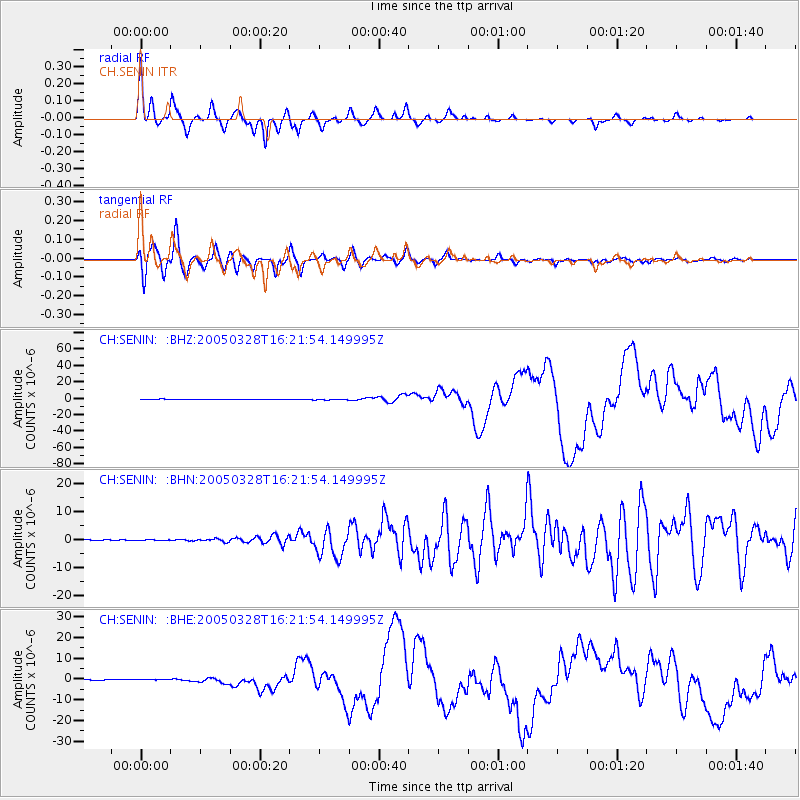
Earthquake location: Northern Sumatra, Indonesia
Earthquake latitude/longitude: 2.1/97.1
Earthquake time(UTC): 2005/03/28 (087) 16:09:36 GMT
Earthquake Depth: 30 km
Earthquake Magnitude: 7.2 MB, 8.4 MS, 8.7 MW, 8.1 MW
Earthquake Catalog/Contributor: WHDF/NEIC
Network: CH Switzerland Seismological Network
Station: SENIN CH.SENIN
Lat/Lon: 46.36 N/7.30 E
Elevation: 2082 m
Distance: 88.4 deg
Az: 316.149 deg
Baz: 88.703 deg
Ray Param: 0.0425979
Estimated Moho Depth: 34.25 km
Estimated Crust Vp/Vs: 1.94
Assumed Crust Vp: 6.276 km/s
Estimated Crust Vs: 3.235 km/s
Estimated Crust Poisson's Ratio: 0.32
Radial Match: 94.27088 %
Radial Bump: 328
Transverse Match: 92.317314 %
Transverse Bump: 400
SOD ConfigId: 2459
Insert Time: 2010-02-25 19:20:34.078 +0000
GWidth: 2.5
Max Bumps: 400
Tol: 0.001

Signal To Noise

ChannelStoNSTALTA
CH:SENIN: :BHN:20050328T16:21:54.149995Z1.36317571.2414634E-79.107141E-8
CH:SENIN: :BHE:20050328T16:21:54.149995Z2.54024482.6374897E-71.0382817E-7
CH:SENIN: :BHZ:20050328T16:21:54.149995Z2.67369846.728159E-72.516424E-7
Arrivals
Ps5.2 SECOND
PpPs16 SECOND
PsPs/PpSs21 SECOND