You are here: Home > Network List > US - United States National Seismic Network Stations List
> Station HAWA Hanford, Washington, USA > Earthquake Result Viewer
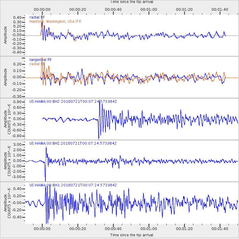
HAWA Hanford, Washington, USA - Earthquake Result Viewer
*The percent match for this event was below the threshold and hence no stack was calculated.
| Earthquake location: |
Mariana Islands |
| Earthquake latitude/longitude: |
18.5/146.0 |
| Earthquake time(UTC): |
2018/07/20 (201) 23:56:00 GMT |
| Earthquake Depth: |
126 km |
| Earthquake Magnitude: |
5.6 Mww |
| Earthquake Catalog/Contributor: |
NEIC PDE/us |
|
| Network: |
US United States National Seismic Network |
| Station: |
HAWA Hanford, Washington, USA |
| Lat/Lon: |
46.39 N/119.53 W |
| Elevation: |
364 m |
|
| Distance: |
79.9 deg |
| Az: |
44.507 deg |
| Baz: |
286.001 deg |
| Ray Param: |
$rayparam |
*The percent match for this event was below the threshold and hence was not used in the summary stack. |
|
| Radial Match: |
72.576775 % |
| Radial Bump: |
400 |
| Transverse Match: |
61.658707 % |
| Transverse Bump: |
400 |
| SOD ConfigId: |
2778632 |
| Insert Time: |
2018-08-04 00:01:28.192 +0000 |
| GWidth: |
2.5 |
| Max Bumps: |
400 |
| Tol: |
0.001 |
|
Signal To Noise
| Channel | StoN | STA | LTA |
| US:HAWA:00:BHZ:20180721T00:07:24.573984Z | 10.785436 | 1.0871837E-6 | 1.00801095E-7 |
| US:HAWA:00:BH1:20180721T00:07:24.573984Z | 4.189009 | 2.5332272E-7 | 6.047318E-8 |
| US:HAWA:00:BH2:20180721T00:07:24.573984Z | 8.563336 | 4.5802267E-7 | 5.3486474E-8 |
| Arrivals |
| Ps | |
| PpPs | |
| PsPs/PpSs | |


