You are here: Home > Network List > US - United States National Seismic Network Stations List
> Station MSO Missoula, Montana, USA > Earthquake Result Viewer
MSO Missoula, Montana, USA - Earthquake Result Viewer
*The percent match for this event was below the threshold and hence no stack was calculated.
| Earthquake location: |
Mariana Islands |
| Earthquake latitude/longitude: |
18.5/146.0 |
| Earthquake time(UTC): |
2018/07/20 (201) 23:56:00 GMT |
| Earthquake Depth: |
126 km |
| Earthquake Magnitude: |
5.6 Mww |
| Earthquake Catalog/Contributor: |
NEIC PDE/us |
|
| Network: |
US United States National Seismic Network |
| Station: |
MSO Missoula, Montana, USA |
| Lat/Lon: |
46.83 N/113.94 W |
| Elevation: |
1264 m |
|
| Distance: |
83.4 deg |
| Az: |
42.889 deg |
| Baz: |
289.817 deg |
| Ray Param: |
$rayparam |
*The percent match for this event was below the threshold and hence was not used in the summary stack. |
|
| Radial Match: |
34.427643 % |
| Radial Bump: |
400 |
| Transverse Match: |
31.28992 % |
| Transverse Bump: |
400 |
| SOD ConfigId: |
2778632 |
| Insert Time: |
2018-08-04 00:01:38.867 +0000 |
| GWidth: |
2.5 |
| Max Bumps: |
400 |
| Tol: |
0.001 |
|
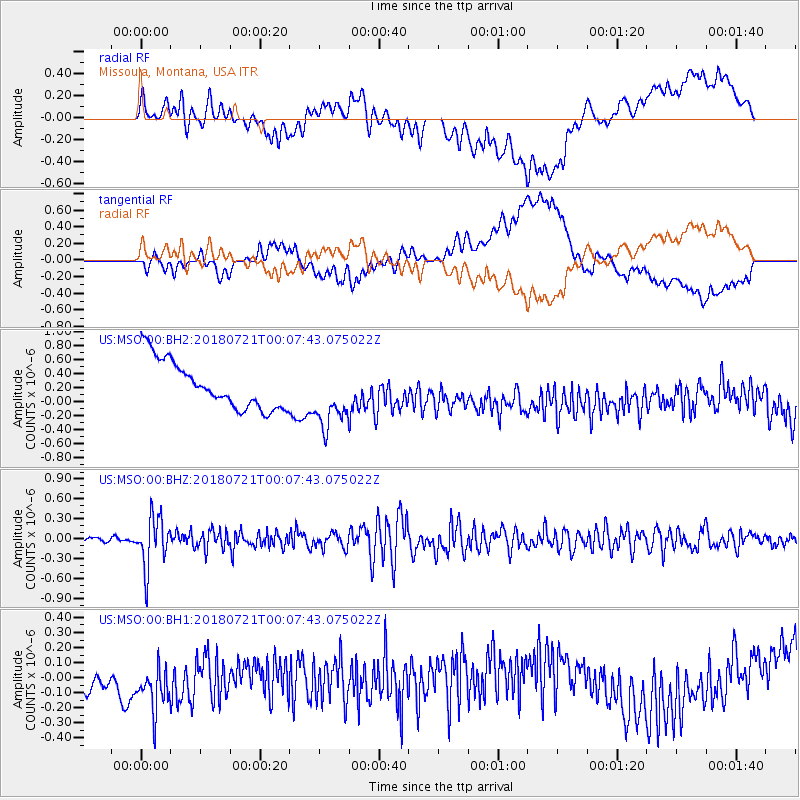
Signal To Noise
| Channel | StoN | STA | LTA |
| US:MSO:00:BHZ:20180721T00:07:43.075022Z | 7.6254582 | 3.8003952E-7 | 4.9838253E-8 |
| US:MSO:00:BH1:20180721T00:07:43.075022Z | 1.4041474 | 2.5217457E-7 | 1.7959266E-7 |
| US:MSO:00:BH2:20180721T00:07:43.075022Z | 1.3230675 | 4.478854E-7 | 3.3852046E-7 |
| Arrivals |
| Ps | |
| PpPs | |
| PsPs/PpSs | |


