You are here: Home > Network List > US - United States National Seismic Network Stations List
> Station MIAR Mount Ida, Arkansas, USA > Earthquake Result Viewer
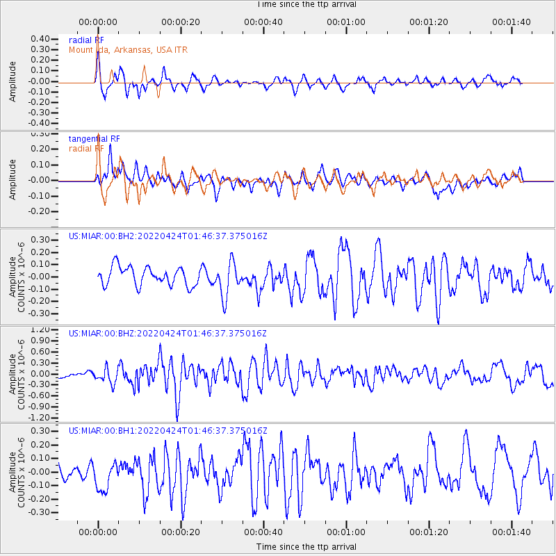
MIAR Mount Ida, Arkansas, USA - Earthquake Result Viewer
*The percent match for this event was below the threshold and hence no stack was calculated.
| Earthquake location: |
Kuril Islands |
| Earthquake latitude/longitude: |
46.0/152.8 |
| Earthquake time(UTC): |
2022/04/24 (114) 01:35:01 GMT |
| Earthquake Depth: |
20 km |
| Earthquake Magnitude: |
5.7 Mww |
| Earthquake Catalog/Contributor: |
NEIC PDE/us |
|
| Network: |
US United States National Seismic Network |
| Station: |
MIAR Mount Ida, Arkansas, USA |
| Lat/Lon: |
34.55 N/93.58 W |
| Elevation: |
207 m |
|
| Distance: |
80.0 deg |
| Az: |
50.171 deg |
| Baz: |
319.596 deg |
| Ray Param: |
$rayparam |
*The percent match for this event was below the threshold and hence was not used in the summary stack. |
|
| Radial Match: |
72.956604 % |
| Radial Bump: |
400 |
| Transverse Match: |
57.624226 % |
| Transverse Bump: |
400 |
| SOD ConfigId: |
27527651 |
| Insert Time: |
2022-05-08 02:03:05.820 +0000 |
| GWidth: |
2.5 |
| Max Bumps: |
400 |
| Tol: |
0.001 |
|
Signal To Noise
| Channel | StoN | STA | LTA |
| US:MIAR:00:BHZ:20220424T01:46:37.375016Z | 3.1037014 | 2.0352451E-7 | 6.5574774E-8 |
| US:MIAR:00:BH1:20220424T01:46:37.375016Z | 2.0284429 | 1.1490287E-7 | 5.664585E-8 |
| US:MIAR:00:BH2:20220424T01:46:37.375016Z | 1.9786361 | 1.4730382E-7 | 7.444715E-8 |
| Arrivals |
| Ps | |
| PpPs | |
| PsPs/PpSs | |


