You are here: Home > Network List > US - United States National Seismic Network Stations List
> Station WMOK Wichita Mountains, Oklahoma, USA > Earthquake Result Viewer
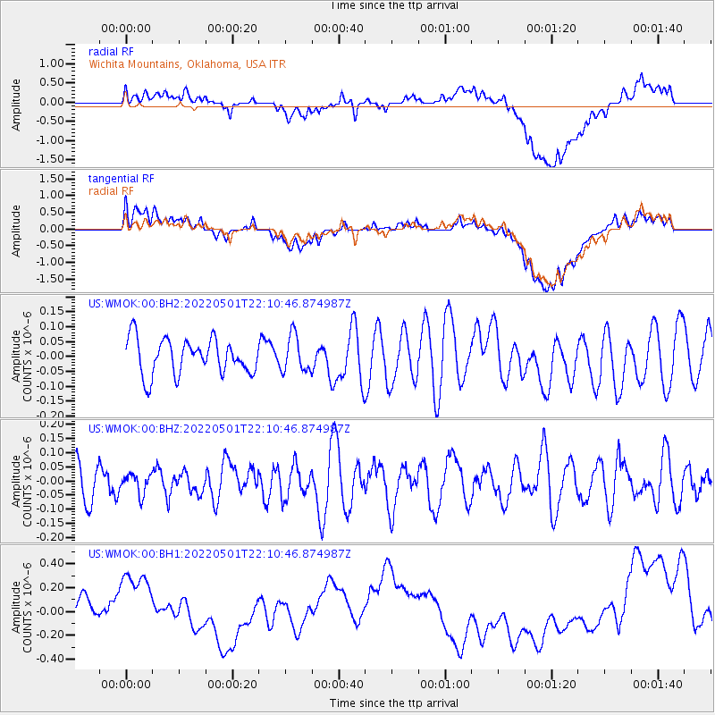
WMOK Wichita Mountains, Oklahoma, USA - Earthquake Result Viewer
*The percent match for this event was below the threshold and hence no stack was calculated.
| Earthquake location: |
Volcano Islands, Japan Region |
| Earthquake latitude/longitude: |
23.6/142.7 |
| Earthquake time(UTC): |
2022/05/01 (121) 21:57:48 GMT |
| Earthquake Depth: |
51 km |
| Earthquake Magnitude: |
5.6 mww |
| Earthquake Catalog/Contributor: |
NEIC PDE/us |
|
| Network: |
US United States National Seismic Network |
| Station: |
WMOK Wichita Mountains, Oklahoma, USA |
| Lat/Lon: |
34.74 N/98.78 W |
| Elevation: |
486 m |
|
| Distance: |
97.7 deg |
| Az: |
46.925 deg |
| Baz: |
305.564 deg |
| Ray Param: |
$rayparam |
*The percent match for this event was below the threshold and hence was not used in the summary stack. |
|
| Radial Match: |
46.14351 % |
| Radial Bump: |
400 |
| Transverse Match: |
40.497135 % |
| Transverse Bump: |
400 |
| SOD ConfigId: |
27527651 |
| Insert Time: |
2022-05-15 22:20:09.641 +0000 |
| GWidth: |
2.5 |
| Max Bumps: |
400 |
| Tol: |
0.001 |
|
Signal To Noise
| Channel | StoN | STA | LTA |
| US:WMOK:00:BHZ:20220501T22:10:46.874987Z | 0.34929764 | 3.4669995E-8 | 9.9256305E-8 |
| US:WMOK:00:BH1:20220501T22:10:46.874987Z | 1.6187518 | 4.8042057E-7 | 2.9678458E-7 |
| US:WMOK:00:BH2:20220501T22:10:46.874987Z | 1.0332013 | 6.100739E-8 | 5.9046954E-8 |
| Arrivals |
| Ps | |
| PpPs | |
| PsPs/PpSs | |


