You are here: Home > Network List > UW - Pacific Northwest Regional Seismic Network Stations List
> Station UMAT Pilot Rock, OR, USA > Earthquake Result Viewer
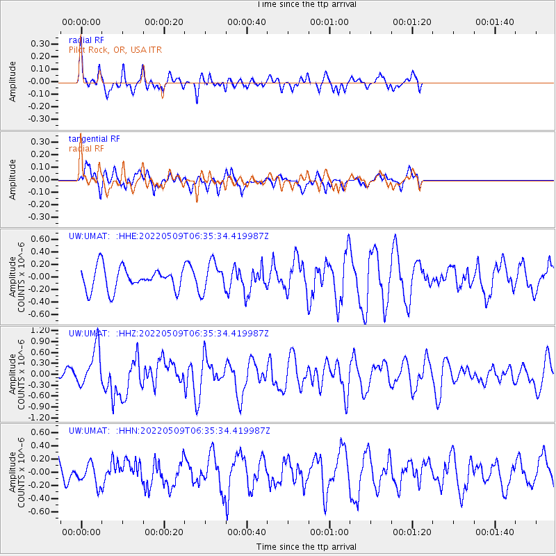
UMAT Pilot Rock, OR, USA - Earthquake Result Viewer
*The percent match for this event was below the threshold and hence no stack was calculated.
| Earthquake location: |
Taiwan Region |
| Earthquake latitude/longitude: |
24.0/122.5 |
| Earthquake time(UTC): |
2022/05/09 (129) 06:23:03 GMT |
| Earthquake Depth: |
27 km |
| Earthquake Magnitude: |
6.3 mww |
| Earthquake Catalog/Contributor: |
NEIC PDE/us |
|
| Network: |
UW Pacific Northwest Regional Seismic Network |
| Station: |
UMAT Pilot Rock, OR, USA |
| Lat/Lon: |
45.29 N/118.96 W |
| Elevation: |
1318 m |
|
| Distance: |
91.2 deg |
| Az: |
38.336 deg |
| Baz: |
306.536 deg |
| Ray Param: |
$rayparam |
*The percent match for this event was below the threshold and hence was not used in the summary stack. |
|
| Radial Match: |
56.280296 % |
| Radial Bump: |
318 |
| Transverse Match: |
59.96199 % |
| Transverse Bump: |
400 |
| SOD ConfigId: |
27527651 |
| Insert Time: |
2022-05-23 06:47:04.405 +0000 |
| GWidth: |
2.5 |
| Max Bumps: |
400 |
| Tol: |
0.001 |
|
Signal To Noise
| Channel | StoN | STA | LTA |
| UW:UMAT: :HHZ:20220509T06:35:34.419987Z | 2.5907402 | 5.5940404E-7 | 2.159244E-7 |
| UW:UMAT: :HHN:20220509T06:35:34.419987Z | 0.9307116 | 1.641525E-7 | 1.7637309E-7 |
| UW:UMAT: :HHE:20220509T06:35:34.419987Z | 1.3098514 | 2.3298605E-7 | 1.7787212E-7 |
| Arrivals |
| Ps | |
| PpPs | |
| PsPs/PpSs | |


