You are here: Home > Network List > US - United States National Seismic Network Stations List
> Station MSO Missoula, Montana, USA > Earthquake Result Viewer
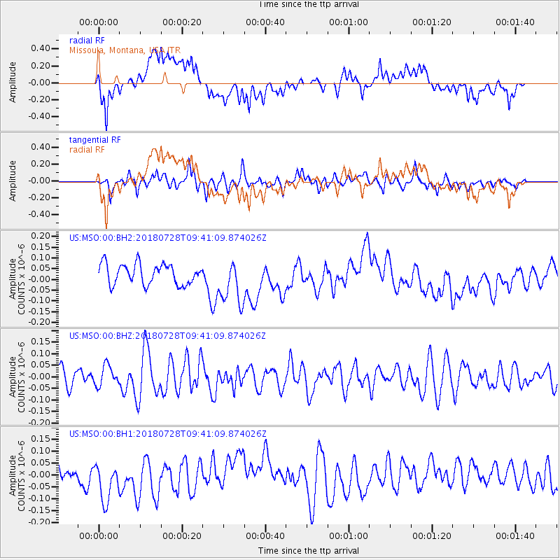
MSO Missoula, Montana, USA - Earthquake Result Viewer
*The percent match for this event was below the threshold and hence no stack was calculated.
| Earthquake location: |
Kermadec Islands, New Zealand |
| Earthquake latitude/longitude: |
-30.0/-177.4 |
| Earthquake time(UTC): |
2018/07/28 (209) 09:28:20 GMT |
| Earthquake Depth: |
35 km |
| Earthquake Magnitude: |
5.6 Mww |
| Earthquake Catalog/Contributor: |
NEIC PDE/us |
|
| Network: |
US United States National Seismic Network |
| Station: |
MSO Missoula, Montana, USA |
| Lat/Lon: |
46.83 N/113.94 W |
| Elevation: |
1264 m |
|
| Distance: |
95.5 deg |
| Az: |
38.118 deg |
| Baz: |
231.266 deg |
| Ray Param: |
$rayparam |
*The percent match for this event was below the threshold and hence was not used in the summary stack. |
|
| Radial Match: |
40.028038 % |
| Radial Bump: |
400 |
| Transverse Match: |
43.13917 % |
| Transverse Bump: |
400 |
| SOD ConfigId: |
2778632 |
| Insert Time: |
2018-08-11 09:32:26.449 +0000 |
| GWidth: |
2.5 |
| Max Bumps: |
400 |
| Tol: |
0.001 |
|
Signal To Noise
| Channel | StoN | STA | LTA |
| US:MSO:00:BHZ:20180728T09:41:09.874026Z | 0.8925129 | 4.521381E-8 | 5.0658997E-8 |
| US:MSO:00:BH1:20180728T09:41:09.874026Z | 3.1286612 | 9.369436E-8 | 2.994711E-8 |
| US:MSO:00:BH2:20180728T09:41:09.874026Z | 2.2247694 | 1.04847274E-7 | 4.712726E-8 |
| Arrivals |
| Ps | |
| PpPs | |
| PsPs/PpSs | |


