You are here: Home > Network List > IU - Global Seismograph Network (GSN - IRIS/USGS) Stations List
> Station JOHN Johnston Island, USA > Earthquake Result Viewer
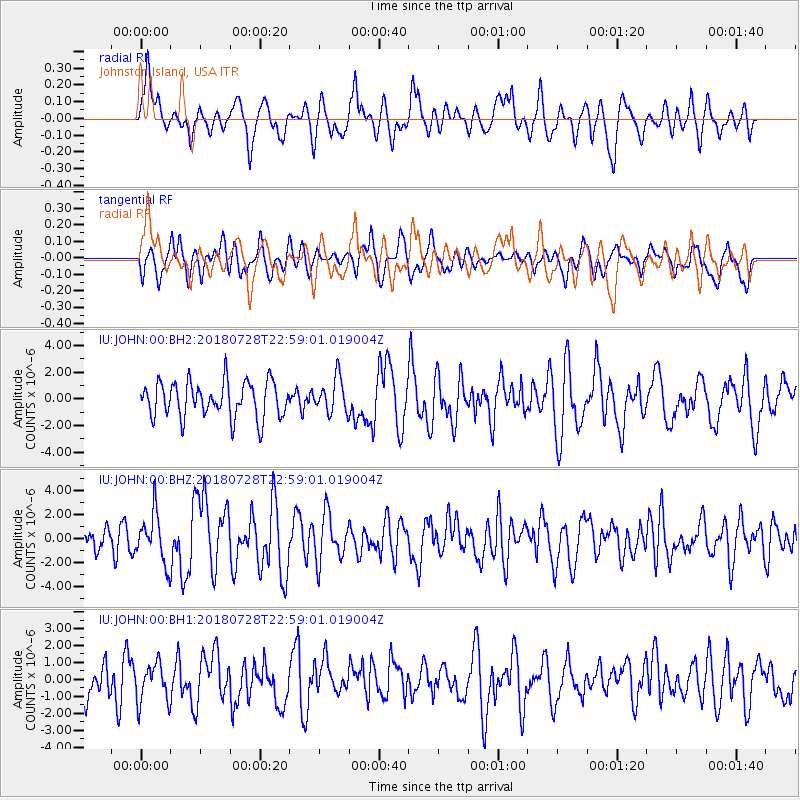
JOHN Johnston Island, USA - Earthquake Result Viewer
*The percent match for this event was below the threshold and hence no stack was calculated.
| Earthquake location: |
Sumbawa Region, Indonesia |
| Earthquake latitude/longitude: |
-8.3/116.5 |
| Earthquake time(UTC): |
2018/07/28 (209) 22:47:37 GMT |
| Earthquake Depth: |
6.4 km |
| Earthquake Magnitude: |
6.4 Mww |
| Earthquake Catalog/Contributor: |
NEIC PDE/us |
|
| Network: |
IU Global Seismograph Network (GSN - IRIS/USGS) |
| Station: |
JOHN Johnston Island, USA |
| Lat/Lon: |
16.73 N/169.53 W |
| Elevation: |
2.0 m |
|
| Distance: |
77.2 deg |
| Az: |
70.784 deg |
| Baz: |
257.257 deg |
| Ray Param: |
$rayparam |
*The percent match for this event was below the threshold and hence was not used in the summary stack. |
|
| Radial Match: |
59.781963 % |
| Radial Bump: |
400 |
| Transverse Match: |
58.829643 % |
| Transverse Bump: |
400 |
| SOD ConfigId: |
2778632 |
| Insert Time: |
2018-08-11 22:49:23.118 +0000 |
| GWidth: |
2.5 |
| Max Bumps: |
400 |
| Tol: |
0.001 |
|
Signal To Noise
| Channel | StoN | STA | LTA |
| IU:JOHN:00:BHZ:20180728T22:59:01.019004Z | 1.9428948 | 2.0657492E-6 | 1.0632326E-6 |
| IU:JOHN:00:BH1:20180728T22:59:01.019004Z | 1.0917175 | 1.1370394E-6 | 1.0415142E-6 |
| IU:JOHN:00:BH2:20180728T22:59:01.019004Z | 0.9654915 | 1.2884734E-6 | 1.3345259E-6 |
| Arrivals |
| Ps | |
| PpPs | |
| PsPs/PpSs | |


