You are here: Home > Network List > TX - Texas Seismological Network Stations List
> Station WTFS Witchita Falls > Earthquake Result Viewer
WTFS Witchita Falls - Earthquake Result Viewer
*The percent match for this event was below the threshold and hence no stack was calculated.
| Earthquake location: |
Near Coast Of Peru |
| Earthquake latitude/longitude: |
-12.4/-76.9 |
| Earthquake time(UTC): |
2022/05/12 (132) 21:55:48 GMT |
| Earthquake Depth: |
56 km |
| Earthquake Magnitude: |
5.4 Mww |
| Earthquake Catalog/Contributor: |
NEIC PDE/us |
|
| Network: |
TX Texas Seismological Network |
| Station: |
WTFS Witchita Falls |
| Lat/Lon: |
33.77 N/98.46 W |
| Elevation: |
277 m |
|
| Distance: |
50.3 deg |
| Az: |
336.525 deg |
| Baz: |
152.144 deg |
| Ray Param: |
$rayparam |
*The percent match for this event was below the threshold and hence was not used in the summary stack. |
|
| Radial Match: |
55.379494 % |
| Radial Bump: |
400 |
| Transverse Match: |
63.770756 % |
| Transverse Bump: |
400 |
| SOD ConfigId: |
27527651 |
| Insert Time: |
2022-05-26 22:16:29.606 +0000 |
| GWidth: |
2.5 |
| Max Bumps: |
400 |
| Tol: |
0.001 |
|
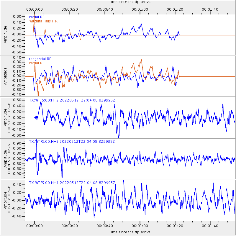
Signal To Noise
| Channel | StoN | STA | LTA |
| TX:WTFS:00:HHZ:20220512T22:04:08.829995Z | 3.6130092 | 4.3790956E-7 | 1.2120356E-7 |
| TX:WTFS:00:HH1:20220512T22:04:08.829995Z | 0.5904855 | 6.671959E-8 | 1.1299108E-7 |
| TX:WTFS:00:HH2:20220512T22:04:08.829995Z | 0.93190956 | 1.7023682E-7 | 1.8267527E-7 |
| Arrivals |
| Ps | |
| PpPs | |
| PsPs/PpSs | |


