You are here: Home > Network List > XM99 - Rio Grande Seismic Transect Stations List
> Station NM13 NewMexico13 > Earthquake Result Viewer
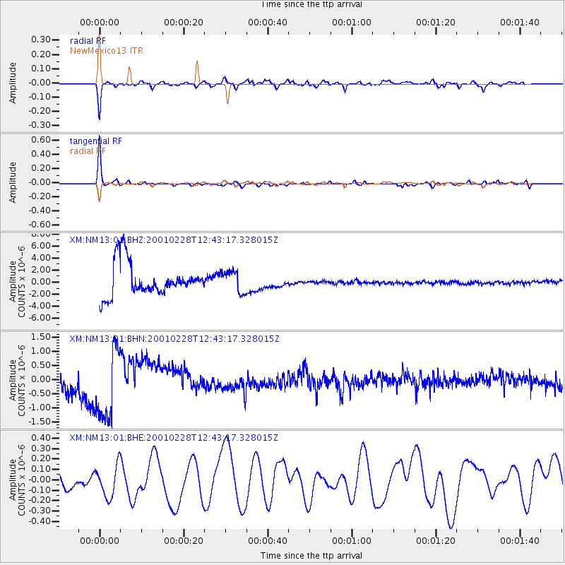
NM13 NewMexico13 - Earthquake Result Viewer
*The percent match for this event was below the threshold and hence no stack was calculated.
| Earthquake location: |
Southeast Of Loyalty Islands |
| Earthquake latitude/longitude: |
-22.0/170.2 |
| Earthquake time(UTC): |
2001/02/28 (059) 12:30:14 GMT |
| Earthquake Depth: |
10 km |
| Earthquake Magnitude: |
6.0 MB, 6.5 MS, 6.7 MW, 6.5 MW |
| Earthquake Catalog/Contributor: |
WHDF/NEIC |
|
| Network: |
XM Rio Grande Seismic Transect |
| Station: |
NM13 NewMexico13 |
| Lat/Lon: |
32.80 N/104.65 W |
| Elevation: |
1177 m |
|
| Distance: |
97.7 deg |
| Az: |
57.871 deg |
| Baz: |
248.952 deg |
| Ray Param: |
$rayparam |
*The percent match for this event was below the threshold and hence was not used in the summary stack. |
|
| Radial Match: |
86.02089 % |
| Radial Bump: |
400 |
| Transverse Match: |
94.86632 % |
| Transverse Bump: |
252 |
| SOD ConfigId: |
3744 |
| Insert Time: |
2010-02-26 17:24:31.031 +0000 |
| GWidth: |
2.5 |
| Max Bumps: |
400 |
| Tol: |
0.001 |
|
Signal To Noise
| Channel | StoN | STA | LTA |
| XM:NM13:01:BHN:20010228T12:43:17.328015Z | 0.89442235 | 1.2201936E-6 | 1.3642252E-6 |
| XM:NM13:01:BHE:20010228T12:43:17.328015Z | 1.5293788 | 1.6189303E-7 | 1.0585541E-7 |
| XM:NM13:01:BHZ:20010228T12:43:17.328015Z | 0.6376209 | 1.7835949E-6 | 2.7972653E-6 |
| Arrivals |
| Ps | |
| PpPs | |
| PsPs/PpSs | |


