You are here: Home > Network List > US - United States National Seismic Network Stations List
> Station AMTX Amarillo, Texas, USA > Earthquake Result Viewer
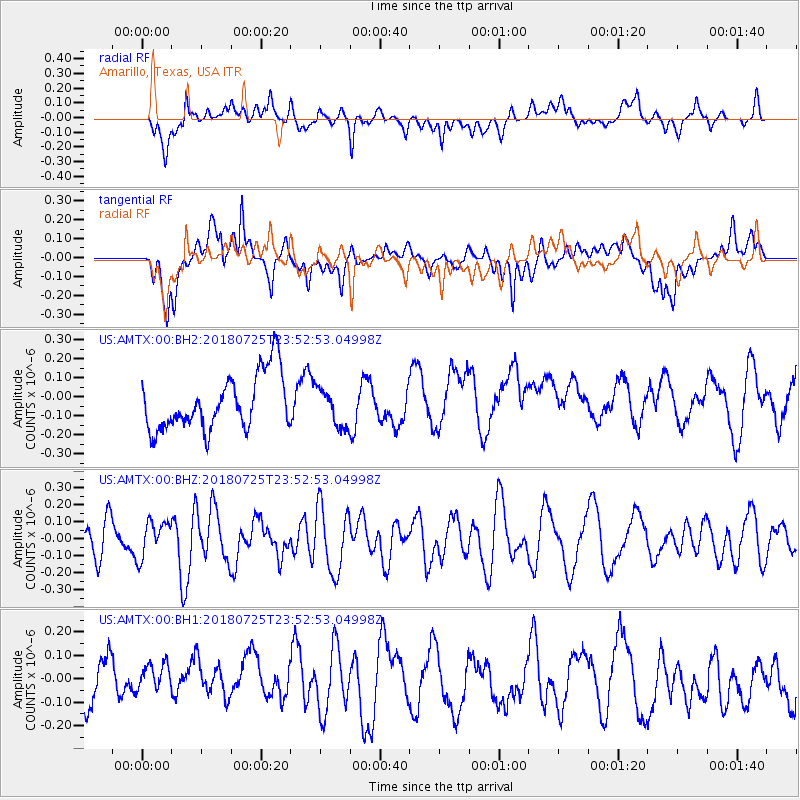
AMTX Amarillo, Texas, USA - Earthquake Result Viewer
*The percent match for this event was below the threshold and hence no stack was calculated.
| Earthquake location: |
Easter Island Region |
| Earthquake latitude/longitude: |
-29.3/-112.2 |
| Earthquake time(UTC): |
2018/07/25 (206) 23:42:46 GMT |
| Earthquake Depth: |
10 km |
| Earthquake Magnitude: |
5.5 Mww |
| Earthquake Catalog/Contributor: |
NEIC PDE/us |
|
| Network: |
US United States National Seismic Network |
| Station: |
AMTX Amarillo, Texas, USA |
| Lat/Lon: |
34.53 N/101.41 W |
| Elevation: |
1010 m |
|
| Distance: |
64.3 deg |
| Az: |
9.92 deg |
| Baz: |
190.5 deg |
| Ray Param: |
$rayparam |
*The percent match for this event was below the threshold and hence was not used in the summary stack. |
|
| Radial Match: |
54.306812 % |
| Radial Bump: |
400 |
| Transverse Match: |
48.884636 % |
| Transverse Bump: |
400 |
| SOD ConfigId: |
2778632 |
| Insert Time: |
2018-08-11 23:24:02.790 +0000 |
| GWidth: |
2.5 |
| Max Bumps: |
400 |
| Tol: |
0.001 |
|
Signal To Noise
| Channel | StoN | STA | LTA |
| US:AMTX:00:BHZ:20180725T23:52:53.04998Z | 1.2618525 | 1.04925256E-7 | 8.3151754E-8 |
| US:AMTX:00:BH1:20180725T23:52:53.04998Z | 0.91345364 | 9.214849E-8 | 1.0087922E-7 |
| US:AMTX:00:BH2:20180725T23:52:53.04998Z | 0.84558207 | 1.2138732E-7 | 1.4355474E-7 |
| Arrivals |
| Ps | |
| PpPs | |
| PsPs/PpSs | |


