You are here: Home > Network List > CN - Canadian National Seismograph Network Stations List
> Station INK INUVIK, NT > Earthquake Result Viewer
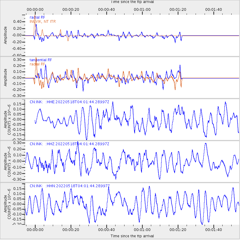
INK INUVIK, NT - Earthquake Result Viewer
*The percent match for this event was below the threshold and hence no stack was calculated.
| Earthquake location: |
Off East Coast Of Honshu, Japan |
| Earthquake latitude/longitude: |
33.3/141.4 |
| Earthquake time(UTC): |
2022/05/18 (138) 03:52:25 GMT |
| Earthquake Depth: |
13 km |
| Earthquake Magnitude: |
5.6 mww |
| Earthquake Catalog/Contributor: |
NEIC PDE/us |
|
| Network: |
CN Canadian National Seismograph Network |
| Station: |
INK INUVIK, NT |
| Lat/Lon: |
68.31 N/133.53 W |
| Elevation: |
44 m |
|
| Distance: |
57.7 deg |
| Az: |
25.993 deg |
| Baz: |
279.32 deg |
| Ray Param: |
$rayparam |
*The percent match for this event was below the threshold and hence was not used in the summary stack. |
|
| Radial Match: |
62.277985 % |
| Radial Bump: |
400 |
| Transverse Match: |
58.855186 % |
| Transverse Bump: |
326 |
| SOD ConfigId: |
27527651 |
| Insert Time: |
2022-06-01 20:30:45.443 +0000 |
| GWidth: |
2.5 |
| Max Bumps: |
400 |
| Tol: |
0.001 |
|
Signal To Noise
| Channel | StoN | STA | LTA |
| CN:INK: :HHZ:20220518T04:01:44.28997Z | 0.8343794 | 6.783208E-8 | 8.1296456E-8 |
| CN:INK: :HHN:20220518T04:01:44.28997Z | 1.1404079 | 7.769671E-8 | 6.813063E-8 |
| CN:INK: :HHE:20220518T04:01:44.28997Z | 2.2941976 | 1.1063441E-7 | 4.8223576E-8 |
| Arrivals |
| Ps | |
| PpPs | |
| PsPs/PpSs | |


