You are here: Home > Network List > GS - US Geological Survey Networks Stations List
> Station KAN13 Rinehart Farm > Earthquake Result Viewer
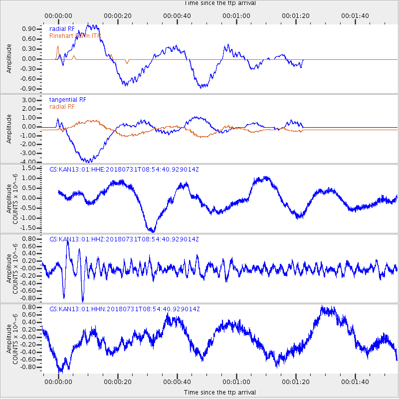
KAN13 Rinehart Farm - Earthquake Result Viewer
*The percent match for this event was below the threshold and hence no stack was calculated.
| Earthquake location: |
Near East Coast Of Honshu, Japan |
| Earthquake latitude/longitude: |
37.2/141.2 |
| Earthquake time(UTC): |
2018/07/31 (212) 08:42:20 GMT |
| Earthquake Depth: |
10 km |
| Earthquake Magnitude: |
5.4 Mww |
| Earthquake Catalog/Contributor: |
NEIC PDE/us |
|
| Network: |
GS US Geological Survey Networks |
| Station: |
KAN13 Rinehart Farm |
| Lat/Lon: |
37.01 N/97.48 W |
| Elevation: |
340 m |
|
| Distance: |
88.4 deg |
| Az: |
43.141 deg |
| Baz: |
316.973 deg |
| Ray Param: |
$rayparam |
*The percent match for this event was below the threshold and hence was not used in the summary stack. |
|
| Radial Match: |
48.191406 % |
| Radial Bump: |
400 |
| Transverse Match: |
40.576168 % |
| Transverse Bump: |
400 |
| SOD ConfigId: |
2778632 |
| Insert Time: |
2018-08-14 08:50:31.555 +0000 |
| GWidth: |
2.5 |
| Max Bumps: |
400 |
| Tol: |
0.001 |
|
Signal To Noise
| Channel | StoN | STA | LTA |
| GS:KAN13:01:HHZ:20180731T08:54:40.929014Z | 5.23151 | 3.8202728E-7 | 7.302428E-8 |
| GS:KAN13:01:HHN:20180731T08:54:40.929014Z | 1.2498686 | 8.287299E-7 | 6.630536E-7 |
| GS:KAN13:01:HHE:20180731T08:54:40.929014Z | 4.9143944 | 1.6357945E-6 | 3.3285784E-7 |
| Arrivals |
| Ps | |
| PpPs | |
| PsPs/PpSs | |


