You are here: Home > Network List > UW - Pacific Northwest Regional Seismic Network Stations List
> Station LEBA Lebam, WA, USA > Earthquake Result Viewer
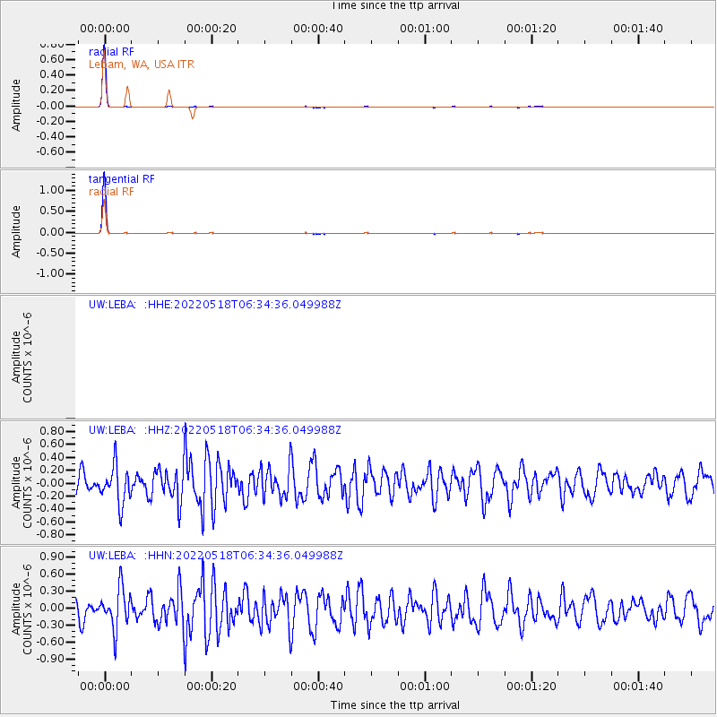
LEBA Lebam, WA, USA - Earthquake Result Viewer
*The percent match for this event was below the threshold and hence no stack was calculated.
| Earthquake location: |
Rat Islands, Aleutian Islands |
| Earthquake latitude/longitude: |
51.1/178.6 |
| Earthquake time(UTC): |
2022/05/18 (138) 06:27:56 GMT |
| Earthquake Depth: |
36 km |
| Earthquake Magnitude: |
5.6 Mb |
| Earthquake Catalog/Contributor: |
NEIC PDE/at |
|
| Network: |
UW Pacific Northwest Regional Seismic Network |
| Station: |
LEBA Lebam, WA, USA |
| Lat/Lon: |
46.55 N/123.56 W |
| Elevation: |
73 m |
|
| Distance: |
37.5 deg |
| Az: |
73.677 deg |
| Baz: |
298.764 deg |
| Ray Param: |
$rayparam |
*The percent match for this event was below the threshold and hence was not used in the summary stack. |
|
| Radial Match: |
99.63653 % |
| Radial Bump: |
64 |
| Transverse Match: |
99.63653 % |
| Transverse Bump: |
64 |
| SOD ConfigId: |
27527651 |
| Insert Time: |
2022-06-01 21:34:37.274 +0000 |
| GWidth: |
2.5 |
| Max Bumps: |
400 |
| Tol: |
0.001 |
|
Signal To Noise
| Channel | StoN | STA | LTA |
| UW:LEBA: :HHZ:20220518T06:34:36.049988Z | 3.0296094 | 2.9661715E-7 | 9.790606E-8 |
| UW:LEBA: :HHN:20220518T06:34:36.049988Z | 3.0441177 | 3.6053905E-7 | 1.18437946E-7 |
| $trig.getChannelId() | $trig.getValue() | $trig.getSTA() | $trig.getLTA() |
| Arrivals |
| Ps | |
| PpPs | |
| PsPs/PpSs | |


