You are here: Home > Network List > US - United States National Seismic Network Stations List
> Station EGMT Eagleton, Montana, USA > Earthquake Result Viewer
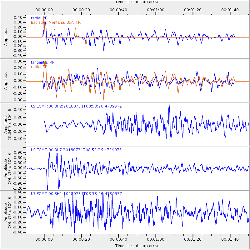
EGMT Eagleton, Montana, USA - Earthquake Result Viewer
*The percent match for this event was below the threshold and hence no stack was calculated.
| Earthquake location: |
Near East Coast Of Honshu, Japan |
| Earthquake latitude/longitude: |
37.2/141.2 |
| Earthquake time(UTC): |
2018/07/31 (212) 08:42:20 GMT |
| Earthquake Depth: |
10 km |
| Earthquake Magnitude: |
5.4 Mww |
| Earthquake Catalog/Contributor: |
NEIC PDE/us |
|
| Network: |
US United States National Seismic Network |
| Station: |
EGMT Eagleton, Montana, USA |
| Lat/Lon: |
48.02 N/109.75 W |
| Elevation: |
1055 m |
|
| Distance: |
74.3 deg |
| Az: |
41.225 deg |
| Baz: |
308.36 deg |
| Ray Param: |
$rayparam |
*The percent match for this event was below the threshold and hence was not used in the summary stack. |
|
| Radial Match: |
74.11584 % |
| Radial Bump: |
400 |
| Transverse Match: |
75.828545 % |
| Transverse Bump: |
400 |
| SOD ConfigId: |
2778632 |
| Insert Time: |
2018-08-14 08:55:17.733 +0000 |
| GWidth: |
2.5 |
| Max Bumps: |
400 |
| Tol: |
0.001 |
|
Signal To Noise
| Channel | StoN | STA | LTA |
| US:EGMT:00:BHZ:20180731T08:53:26.473997Z | 10.556973 | 4.476389E-7 | 4.2402203E-8 |
| US:EGMT:00:BH1:20180731T08:53:26.473997Z | 1.8150551 | 1.2681652E-7 | 6.986924E-8 |
| US:EGMT:00:BH2:20180731T08:53:26.473997Z | 2.4701602 | 1.6538944E-7 | 6.695495E-8 |
| Arrivals |
| Ps | |
| PpPs | |
| PsPs/PpSs | |


