You are here: Home > Network List > IU - Global Seismograph Network (GSN - IRIS/USGS) Stations List
> Station JOHN Johnston Island, USA > Earthquake Result Viewer
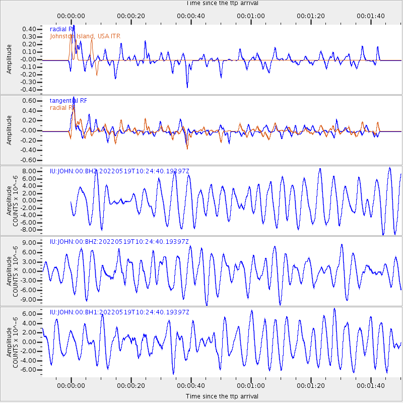
JOHN Johnston Island, USA - Earthquake Result Viewer
*The percent match for this event was below the threshold and hence no stack was calculated.
| Earthquake location: |
Macquarie Island Region |
| Earthquake latitude/longitude: |
-53.8/158.9 |
| Earthquake time(UTC): |
2022/05/19 (139) 10:13:31 GMT |
| Earthquake Depth: |
29 km |
| Earthquake Magnitude: |
7.3 Mi |
| Earthquake Catalog/Contributor: |
NEIC PDE/at |
|
| Network: |
IU Global Seismograph Network (GSN - IRIS/USGS) |
| Station: |
JOHN Johnston Island, USA |
| Lat/Lon: |
16.73 N/169.53 W |
| Elevation: |
2.0 m |
|
| Distance: |
75.3 deg |
| Az: |
31.242 deg |
| Baz: |
198.729 deg |
| Ray Param: |
$rayparam |
*The percent match for this event was below the threshold and hence was not used in the summary stack. |
|
| Radial Match: |
62.178173 % |
| Radial Bump: |
400 |
| Transverse Match: |
61.638348 % |
| Transverse Bump: |
400 |
| SOD ConfigId: |
27527651 |
| Insert Time: |
2022-06-02 10:18:53.769 +0000 |
| GWidth: |
2.5 |
| Max Bumps: |
400 |
| Tol: |
0.001 |
|
Signal To Noise
| Channel | StoN | STA | LTA |
| IU:JOHN:00:BHZ:20220519T10:24:40.19397Z | 2.5730188 | 4.6856085E-6 | 1.8210549E-6 |
| IU:JOHN:00:BH1:20220519T10:24:40.19397Z | 0.8498263 | 2.3565758E-6 | 2.7730089E-6 |
| IU:JOHN:00:BH2:20220519T10:24:40.19397Z | 1.5909064 | 4.9853775E-6 | 3.1336713E-6 |
| Arrivals |
| Ps | |
| PpPs | |
| PsPs/PpSs | |


