You are here: Home > Network List > C8 - Canadian Seismic Research Network () Stations List
> Station GRIB Gribbell Island, BC, CA > Earthquake Result Viewer
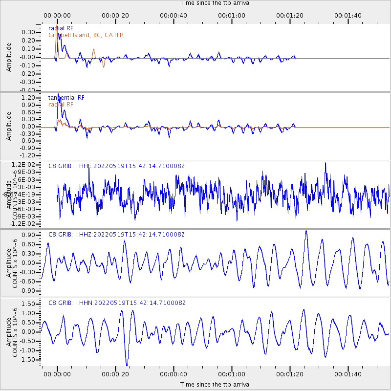
GRIB Gribbell Island, BC, CA - Earthquake Result Viewer
*The percent match for this event was below the threshold and hence no stack was calculated.
| Earthquake location: |
Northern Molucca Sea |
| Earthquake latitude/longitude: |
1.7/126.4 |
| Earthquake time(UTC): |
2022/05/19 (139) 15:29:12 GMT |
| Earthquake Depth: |
3.8 km |
| Earthquake Magnitude: |
5.1 Mww |
| Earthquake Catalog/Contributor: |
NEIC PDE/us |
|
| Network: |
C8 Canadian Seismic Research Network () |
| Station: |
GRIB Gribbell Island, BC, CA |
| Lat/Lon: |
53.34 N/129.14 W |
| Elevation: |
418 m |
|
| Distance: |
97.2 deg |
| Az: |
35.834 deg |
| Baz: |
282.613 deg |
| Ray Param: |
$rayparam |
*The percent match for this event was below the threshold and hence was not used in the summary stack. |
|
| Radial Match: |
77.3906 % |
| Radial Bump: |
395 |
| Transverse Match: |
77.36676 % |
| Transverse Bump: |
400 |
| SOD ConfigId: |
27527651 |
| Insert Time: |
2022-06-02 15:36:27.545 +0000 |
| GWidth: |
2.5 |
| Max Bumps: |
400 |
| Tol: |
0.001 |
|
Signal To Noise
| Channel | StoN | STA | LTA |
| C8:GRIB: :HHZ:20220519T15:42:14.710008Z | 0.6040382 | 1.9945898E-7 | 3.3020922E-7 |
| C8:GRIB: :HHN:20220519T15:42:14.710008Z | 0.83576757 | 4.3708295E-7 | 5.229719E-7 |
| C8:GRIB: :HHE:20220519T15:42:14.710008Z | 0.7730182 | 2.7472018E-9 | 3.5538645E-9 |
| Arrivals |
| Ps | |
| PpPs | |
| PsPs/PpSs | |


