You are here: Home > Network List > G - GEOSCOPE Stations List
> Station INU Inuyama, Japan > Earthquake Result Viewer
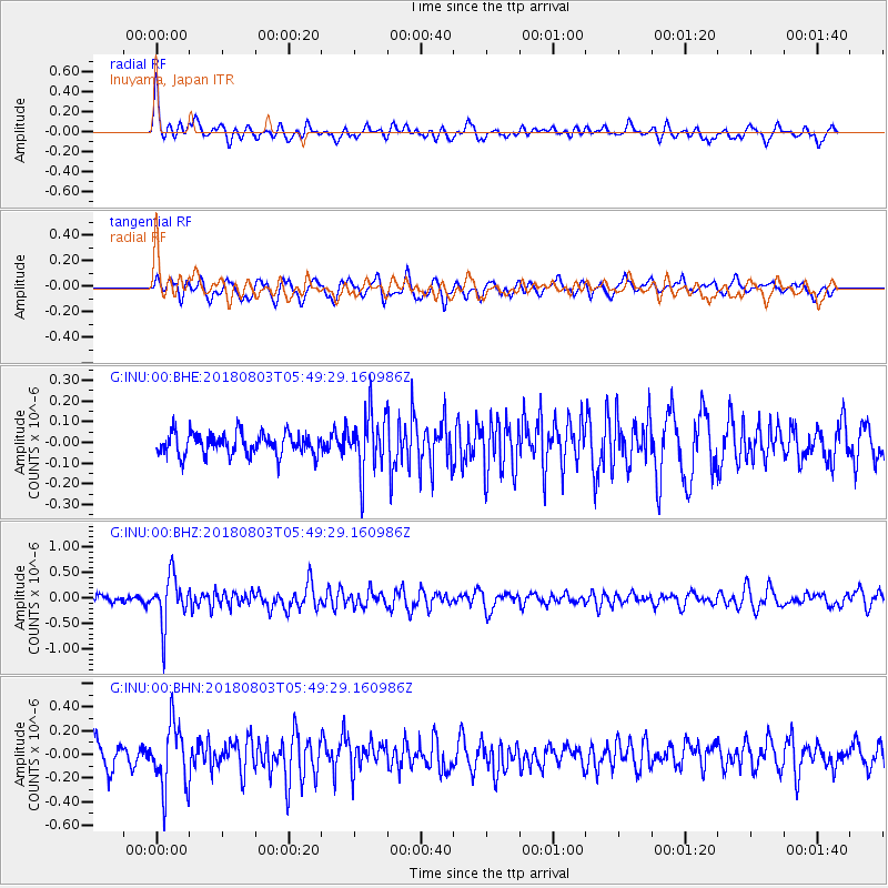
INU Inuyama, Japan - Earthquake Result Viewer
*The percent match for this event was below the threshold and hence no stack was calculated.
| Earthquake location: |
Tanimbar Islands Reg., Indonesia |
| Earthquake latitude/longitude: |
-6.2/132.7 |
| Earthquake time(UTC): |
2018/08/03 (215) 05:42:14 GMT |
| Earthquake Depth: |
28 km |
| Earthquake Magnitude: |
5.4 Mww |
| Earthquake Catalog/Contributor: |
NEIC PDE/us |
|
| Network: |
G GEOSCOPE |
| Station: |
INU Inuyama, Japan |
| Lat/Lon: |
35.35 N/137.03 E |
| Elevation: |
132 m |
|
| Distance: |
41.5 deg |
| Az: |
5.334 deg |
| Baz: |
186.492 deg |
| Ray Param: |
$rayparam |
*The percent match for this event was below the threshold and hence was not used in the summary stack. |
|
| Radial Match: |
63.177105 % |
| Radial Bump: |
400 |
| Transverse Match: |
68.21292 % |
| Transverse Bump: |
400 |
| SOD ConfigId: |
2778632 |
| Insert Time: |
2018-08-17 05:49:44.783 +0000 |
| GWidth: |
2.5 |
| Max Bumps: |
400 |
| Tol: |
0.001 |
|
Signal To Noise
| Channel | StoN | STA | LTA |
| G:INU:00:BHZ:20180803T05:49:29.160986Z | 6.925576 | 4.7474538E-7 | 6.854958E-8 |
| G:INU:00:BHN:20180803T05:49:29.160986Z | 2.0501704 | 2.767667E-7 | 1.3499694E-7 |
| G:INU:00:BHE:20180803T05:49:29.160986Z | 2.6167052 | 1.3974513E-7 | 5.3404996E-8 |
| Arrivals |
| Ps | |
| PpPs | |
| PsPs/PpSs | |


