You are here: Home > Network List > UW - Pacific Northwest Regional Seismic Network Stations List
> Station LEBA Lebam, WA, USA > Earthquake Result Viewer
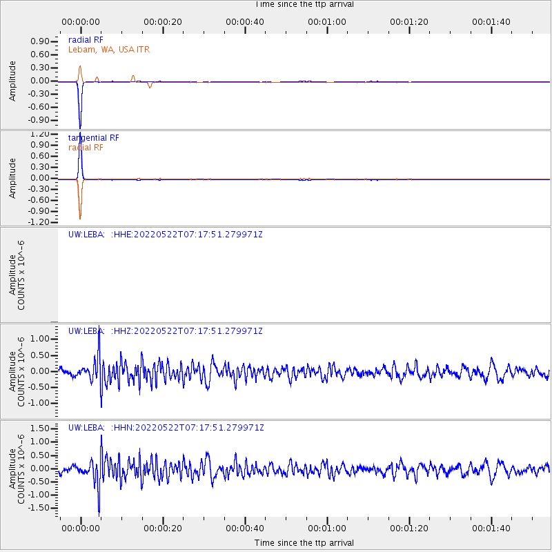
LEBA Lebam, WA, USA - Earthquake Result Viewer
*The percent match for this event was below the threshold and hence no stack was calculated.
| Earthquake location: |
South Of Fiji Islands |
| Earthquake latitude/longitude: |
-26.2/178.4 |
| Earthquake time(UTC): |
2022/05/22 (142) 07:06:27 GMT |
| Earthquake Depth: |
590 km |
| Earthquake Magnitude: |
6.3 mww |
| Earthquake Catalog/Contributor: |
NEIC PDE/us |
|
| Network: |
UW Pacific Northwest Regional Seismic Network |
| Station: |
LEBA Lebam, WA, USA |
| Lat/Lon: |
46.55 N/123.56 W |
| Elevation: |
73 m |
|
| Distance: |
89.4 deg |
| Az: |
35.849 deg |
| Baz: |
229.662 deg |
| Ray Param: |
$rayparam |
*The percent match for this event was below the threshold and hence was not used in the summary stack. |
|
| Radial Match: |
99.36202 % |
| Radial Bump: |
77 |
| Transverse Match: |
99.36203 % |
| Transverse Bump: |
77 |
| SOD ConfigId: |
27527651 |
| Insert Time: |
2022-06-05 07:29:51.928 +0000 |
| GWidth: |
2.5 |
| Max Bumps: |
400 |
| Tol: |
0.001 |
|
Signal To Noise
| Channel | StoN | STA | LTA |
| UW:LEBA: :HHZ:20220522T07:17:51.279971Z | 3.3173852 | 3.9174253E-7 | 1.1808775E-7 |
| UW:LEBA: :HHN:20220522T07:17:51.279971Z | 3.2894878 | 4.7363883E-7 | 1.4398559E-7 |
| $trig.getChannelId() | $trig.getValue() | $trig.getSTA() | $trig.getLTA() |
| Arrivals |
| Ps | |
| PpPs | |
| PsPs/PpSs | |


