You are here: Home > Network List > US - United States National Seismic Network Stations List
> Station DGMT Dagmar, Montana, USA > Earthquake Result Viewer
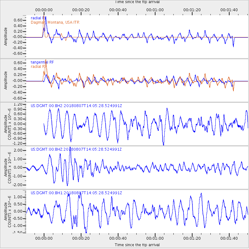
DGMT Dagmar, Montana, USA - Earthquake Result Viewer
*The percent match for this event was below the threshold and hence no stack was calculated.
| Earthquake location: |
Greenland Sea |
| Earthquake latitude/longitude: |
74.6/8.4 |
| Earthquake time(UTC): |
2018/08/07 (219) 13:57:09 GMT |
| Earthquake Depth: |
10 km |
| Earthquake Magnitude: |
5.8 Mww |
| Earthquake Catalog/Contributor: |
NEIC PDE/us |
|
| Network: |
US United States National Seismic Network |
| Station: |
DGMT Dagmar, Montana, USA |
| Lat/Lon: |
48.47 N/104.20 W |
| Elevation: |
0.0 m |
|
| Distance: |
49.4 deg |
| Az: |
305.941 deg |
| Baz: |
18.93 deg |
| Ray Param: |
$rayparam |
*The percent match for this event was below the threshold and hence was not used in the summary stack. |
|
| Radial Match: |
72.721924 % |
| Radial Bump: |
400 |
| Transverse Match: |
64.27674 % |
| Transverse Bump: |
397 |
| SOD ConfigId: |
2778632 |
| Insert Time: |
2018-08-21 14:06:10.560 +0000 |
| GWidth: |
2.5 |
| Max Bumps: |
400 |
| Tol: |
0.001 |
|
Signal To Noise
| Channel | StoN | STA | LTA |
| US:DGMT:00:BHZ:20180807T14:05:28.524991Z | 4.2723365 | 7.190646E-7 | 1.6830711E-7 |
| US:DGMT:00:BH1:20180807T14:05:28.524991Z | 0.88856304 | 3.9446527E-7 | 4.4393616E-7 |
| US:DGMT:00:BH2:20180807T14:05:28.524991Z | 1.1729622 | 5.9858155E-7 | 5.1031617E-7 |
| Arrivals |
| Ps | |
| PpPs | |
| PsPs/PpSs | |


