You are here: Home > Network List > US - United States National Seismic Network Stations List
> Station HAWA Hanford, Washington, USA > Earthquake Result Viewer
HAWA Hanford, Washington, USA - Earthquake Result Viewer
*The percent match for this event was below the threshold and hence no stack was calculated.
| Earthquake location: |
Greenland Sea |
| Earthquake latitude/longitude: |
74.6/8.4 |
| Earthquake time(UTC): |
2018/08/07 (219) 13:57:09 GMT |
| Earthquake Depth: |
10 km |
| Earthquake Magnitude: |
5.8 Mww |
| Earthquake Catalog/Contributor: |
NEIC PDE/us |
|
| Network: |
US United States National Seismic Network |
| Station: |
HAWA Hanford, Washington, USA |
| Lat/Lon: |
46.39 N/119.53 W |
| Elevation: |
364 m |
|
| Distance: |
54.4 deg |
| Az: |
317.82 deg |
| Baz: |
14.993 deg |
| Ray Param: |
$rayparam |
*The percent match for this event was below the threshold and hence was not used in the summary stack. |
|
| Radial Match: |
75.624245 % |
| Radial Bump: |
400 |
| Transverse Match: |
63.043118 % |
| Transverse Bump: |
400 |
| SOD ConfigId: |
2778632 |
| Insert Time: |
2018-08-21 14:06:27.993 +0000 |
| GWidth: |
2.5 |
| Max Bumps: |
400 |
| Tol: |
0.001 |
|
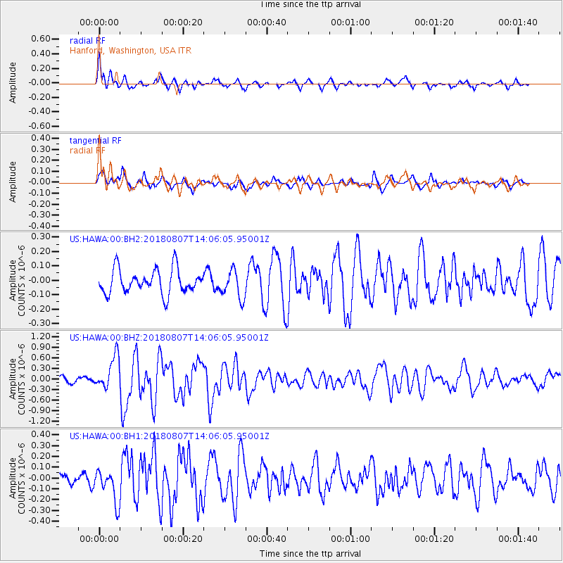
Signal To Noise
| Channel | StoN | STA | LTA |
| US:HAWA:00:BHZ:20180807T14:06:05.95001Z | 5.9258533 | 4.843592E-7 | 8.1736616E-8 |
| US:HAWA:00:BH1:20180807T14:06:05.95001Z | 2.1920547 | 1.5896264E-7 | 7.2517636E-8 |
| US:HAWA:00:BH2:20180807T14:06:05.95001Z | 1.1925583 | 1.0035992E-7 | 8.415515E-8 |
| Arrivals |
| Ps | |
| PpPs | |
| PsPs/PpSs | |


