
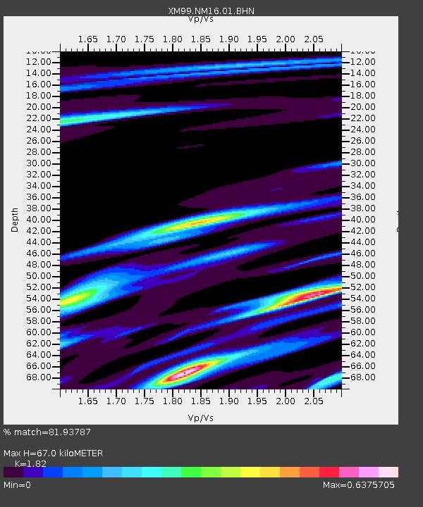
NM16 NewMexico16 - Earthquake Result Viewer
| ||||||||||||||||||
| ||||||||||||||||||
| ||||||||||||||||||
|
Signal To Noise
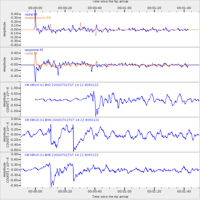
| Channel | StoN | STA | LTA |
| XM:NM16:01:BHN:20000701T07:14:22.806013Z | 1.5318788 | 1.2592571E-7 | 8.2203435E-8 |
| XM:NM16:01:BHE:20000701T07:14:22.806013Z | 1.3561139 | 9.2544425E-8 | 6.824237E-8 |
| XM:NM16:01:BHZ:20000701T07:14:22.806013Z | 1.8335936 | 1.0825543E-7 | 5.9040033E-8 |
| Arrivals | |
| Ps | 9.0 SECOND |
| PpPs | 30 SECOND |
| PsPs/PpSs | 39 SECOND |

