NM16 NewMexico16 - Earthquake Result Viewer
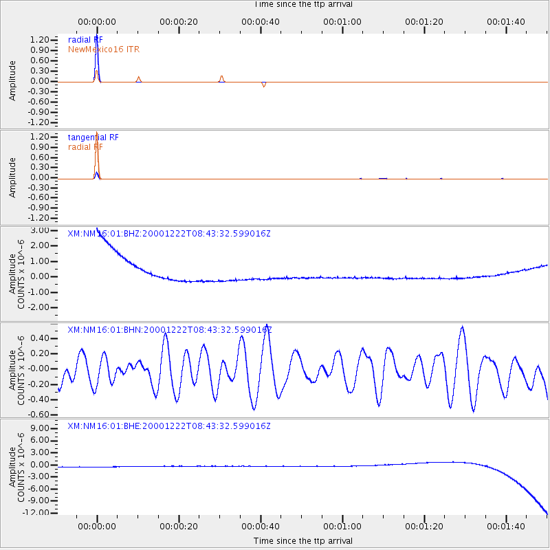
Earthquake location: Santa Cruz Islands Region
Earthquake latitude/longitude: -10.6/164.2
Earthquake time(UTC): 2000/12/22 (357) 08:30:39 GMT
Earthquake Depth: 33 km
Earthquake Magnitude: 5.5 MB, 5.4 MS, 5.9 MW, 5.8 MW
Earthquake Catalog/Contributor: WHDF/NEIC
Network: XM Rio Grande Seismic Transect
Station: NM16 NewMexico16
Lat/Lon: 33.17 N/105.13 W
Elevation: 1625 m
Distance: 96.2 deg
Az: 57.524 deg
Baz: 261.519 deg
Ray Param: 0.04055695
Estimated Moho Depth: 10.0 km
Estimated Crust Vp/Vs: 1.60
Assumed Crust Vp: 6.232 km/s
Estimated Crust Vs: 3.895 km/s
Estimated Crust Poisson's Ratio: 0.18
Radial Match: 99.99983 %
Radial Bump: 2
Transverse Match: 99.69049 %
Transverse Bump: 31
SOD ConfigId: 16820
Insert Time: 2010-02-26 17:25:59.592 +0000
GWidth: 2.5
Max Bumps: 400
Tol: 0.001

Signal To Noise

ChannelStoNSTALTA
XM:NM16:01:BHN:20001222T08:43:32.599016Z0.632896661.7841398E-72.8190067E-7
XM:NM16:01:BHE:20001222T08:43:32.599016Z0.921971268.989727E-79.750551E-7
XM:NM16:01:BHZ:20001222T08:43:32.599016Z0.92186899.007164E-79.770547E-7
Arrivals
Ps1.0 SECOND
PpPs4.1 SECOND
PsPs/PpSs5.1 SECOND