
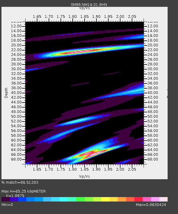
NM16 NewMexico16 - Earthquake Result Viewer
| ||||||||||||||||||
| ||||||||||||||||||
| ||||||||||||||||||
|
Signal To Noise
| Channel | StoN | STA | LTA |
| XM:NM16:01:BHN:20001005T13:48:00.32802Z | 0.9534612 | 2.078306E-7 | 2.1797489E-7 |
| XM:NM16:01:BHE:20001005T13:48:00.32802Z | 1.2882868 | 3.3894992E-7 | 2.6310127E-7 |
| XM:NM16:01:BHZ:20001005T13:48:00.32802Z | 1.2751429 | 3.5273442E-7 | 2.7662347E-7 |
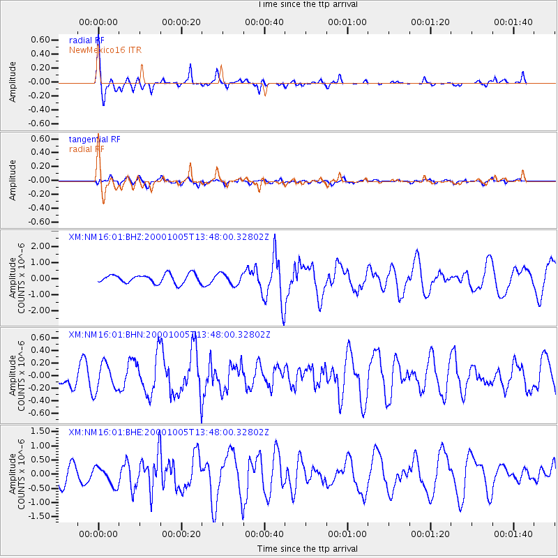
| Arrivals | |
| Ps | 9.9 SECOND |
| PpPs | 29 SECOND |
| PsPs/PpSs | 39 SECOND |

