
NM16 NewMexico16 - Earthquake Result Viewer
| ||||||||||||||||||
| ||||||||||||||||||
| ||||||||||||||||||
|
Signal To Noise
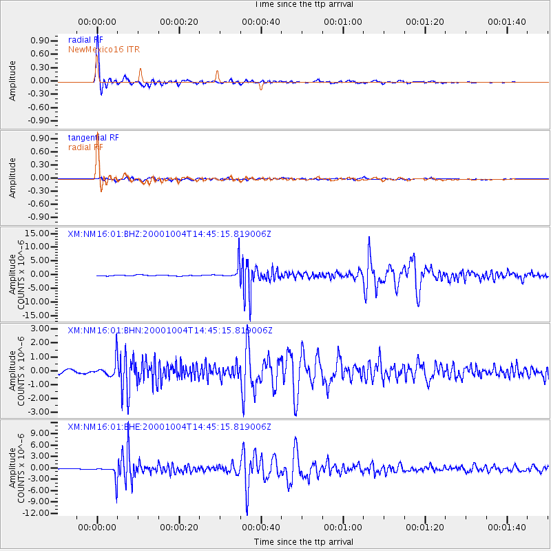
| Channel | StoN | STA | LTA |
| XM:NM16:01:BHN:20001004T14:45:15.819006Z | 4.165003 | 6.562954E-7 | 1.5757384E-7 |
| XM:NM16:01:BHE:20001004T14:45:15.819006Z | 20.55482 | 1.956993E-6 | 9.520848E-8 |
| XM:NM16:01:BHZ:20001004T14:45:15.819006Z | 18.474903 | 3.042592E-6 | 1.6468785E-7 |
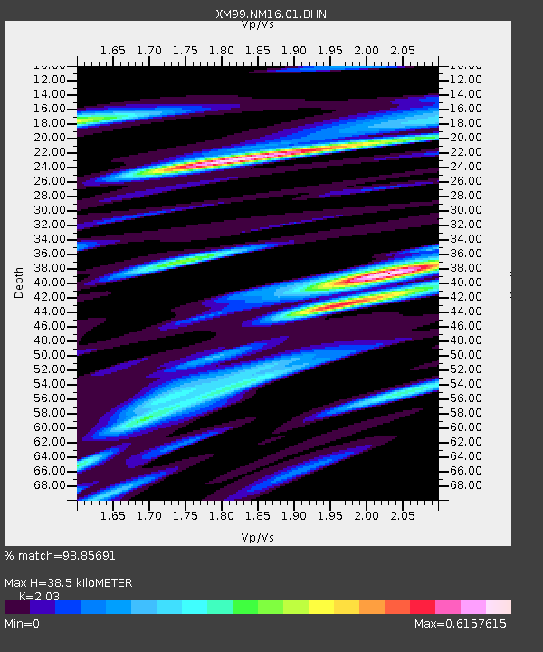
| Arrivals | |
| Ps | 6.7 SECOND |
| PpPs | 18 SECOND |
| PsPs/PpSs | 24 SECOND |

