NM16 NewMexico16 - Earthquake Result Viewer
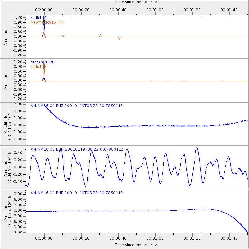
Earthquake location: Santa Cruz Islands
Earthquake latitude/longitude: -11.7/166.4
Earthquake time(UTC): 2001/01/19 (019) 08:10:14 GMT
Earthquake Depth: 50 km
Earthquake Magnitude: 5.7 MB, 6.1 MS, 6.4 MW, 6.3 MW
Earthquake Catalog/Contributor: WHDF/NEIC
Network: XM Rio Grande Seismic Transect
Station: NM16 NewMexico16
Lat/Lon: 33.17 N/105.13 W
Elevation: 1625 m
Distance: 95.0 deg
Az: 57.315 deg
Baz: 259.445 deg
Ray Param: 0.040860727
Estimated Moho Depth: 10.0 km
Estimated Crust Vp/Vs: 1.60
Assumed Crust Vp: 6.232 km/s
Estimated Crust Vs: 3.895 km/s
Estimated Crust Poisson's Ratio: 0.18
Radial Match: 99.99968 %
Radial Bump: 2
Transverse Match: 99.78972 %
Transverse Bump: 35
SOD ConfigId: 16820
Insert Time: 2010-02-26 17:26:12.059 +0000
GWidth: 2.5
Max Bumps: 400
Tol: 0.001

Signal To Noise

ChannelStoNSTALTA
XM:NM16:01:BHN:20010119T08:23:00.786011Z0.63887792.0059221E-73.1397582E-7
XM:NM16:01:BHE:20010119T08:23:00.786011Z0.905254968.793827E-79.714199E-7
XM:NM16:01:BHZ:20010119T08:23:00.786011Z0.906610258.831155E-79.740851E-7
Arrivals
Ps1.0 SECOND
PpPs4.1 SECOND
PsPs/PpSs5.1 SECOND