You are here: Home > Network List > XM99 - Rio Grande Seismic Transect Stations List
> Station NM16 NewMexico16 > Earthquake Result Viewer
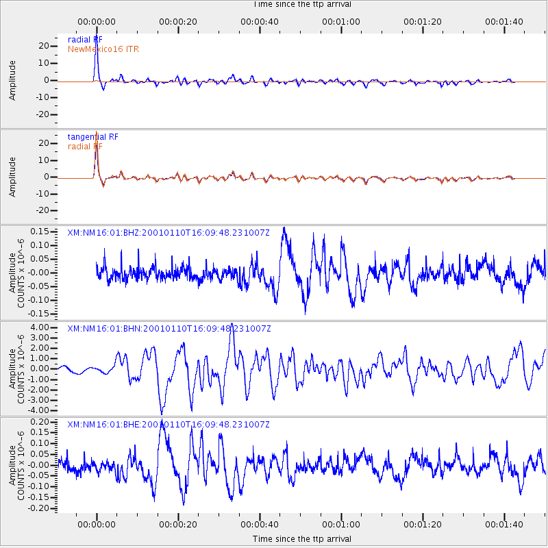
NM16 NewMexico16 - Earthquake Result Viewer
*The percent match for this event was below the threshold and hence no stack was calculated.
| Earthquake location: |
Kodiak Island Region, Alaska |
| Earthquake latitude/longitude: |
57.1/-153.2 |
| Earthquake time(UTC): |
2001/01/10 (010) 16:02:44 GMT |
| Earthquake Depth: |
33 km |
| Earthquake Magnitude: |
6.2 MB, 6.8 MS, 7.1 MW, 6.8 ML |
| Earthquake Catalog/Contributor: |
WHDF/NEIC |
|
| Network: |
XM Rio Grande Seismic Transect |
| Station: |
NM16 NewMexico16 |
| Lat/Lon: |
33.17 N/105.13 W |
| Elevation: |
1625 m |
|
| Distance: |
40.3 deg |
| Az: |
105.406 deg |
| Baz: |
321.119 deg |
| Ray Param: |
$rayparam |
*The percent match for this event was below the threshold and hence was not used in the summary stack. |
|
| Radial Match: |
83.70328 % |
| Radial Bump: |
294 |
| Transverse Match: |
81.50679 % |
| Transverse Bump: |
338 |
| SOD ConfigId: |
3744 |
| Insert Time: |
2010-02-26 17:26:24.473 +0000 |
| GWidth: |
2.5 |
| Max Bumps: |
400 |
| Tol: |
0.001 |
|
Signal To Noise
| Channel | StoN | STA | LTA |
| XM:NM16:01:BHN:20010110T16:09:48.231007Z | 1.1531613 | 3.898946E-7 | 3.3810932E-7 |
| XM:NM16:01:BHE:20010110T16:09:48.231007Z | 1.0075002 | 2.1719927E-8 | 2.1558236E-8 |
| XM:NM16:01:BHZ:20010110T16:09:48.231007Z | 0.86234367 | 1.8405254E-8 | 2.1343293E-8 |
| Arrivals |
| Ps | |
| PpPs | |
| PsPs/PpSs | |


