You are here: Home > Network List > NE - New England Seismic Network Stations List
> Station EMMW Machias, ME > Earthquake Result Viewer
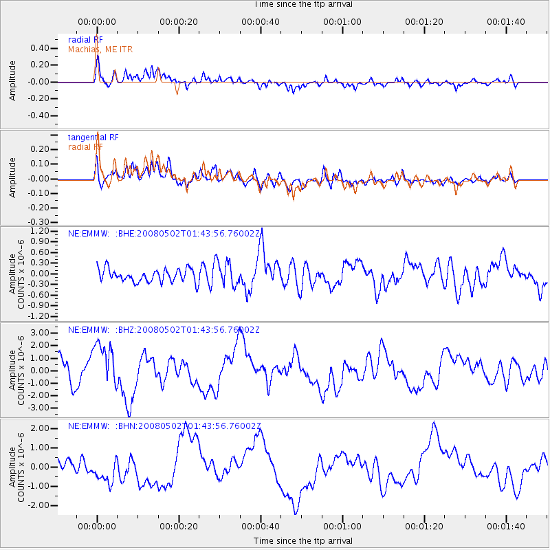
EMMW Machias, ME - Earthquake Result Viewer
*The percent match for this event was below the threshold and hence no stack was calculated.
| Earthquake location: |
Andreanof Islands, Aleutian Is. |
| Earthquake latitude/longitude: |
51.9/-177.5 |
| Earthquake time(UTC): |
2008/05/02 (123) 01:33:37 GMT |
| Earthquake Depth: |
14 km |
| Earthquake Magnitude: |
6.3 MB, 6.8 MS, 6.6 MW, 6.6 MW |
| Earthquake Catalog/Contributor: |
WHDF/NEIC |
|
| Network: |
NE New England Seismic Network |
| Station: |
EMMW Machias, ME |
| Lat/Lon: |
44.71 N/67.46 W |
| Elevation: |
34 m |
|
| Distance: |
66.5 deg |
| Az: |
46.9 deg |
| Baz: |
320.581 deg |
| Ray Param: |
$rayparam |
*The percent match for this event was below the threshold and hence was not used in the summary stack. |
|
| Radial Match: |
62.913563 % |
| Radial Bump: |
400 |
| Transverse Match: |
68.799736 % |
| Transverse Bump: |
400 |
| SOD ConfigId: |
2504 |
| Insert Time: |
2010-03-09 20:22:24.297 +0000 |
| GWidth: |
2.5 |
| Max Bumps: |
400 |
| Tol: |
0.001 |
|
Signal To Noise
| Channel | StoN | STA | LTA |
| NE:EMMW: :BHZ:20080502T01:43:56.76002Z | 2.3391533 | 1.8693137E-6 | 7.9914116E-7 |
| NE:EMMW: :BHN:20080502T01:43:56.76002Z | 2.5666924 | 6.4601136E-7 | 2.5169024E-7 |
| NE:EMMW: :BHE:20080502T01:43:56.76002Z | 2.1224666 | 3.562745E-7 | 1.6785872E-7 |
| Arrivals |
| Ps | |
| PpPs | |
| PsPs/PpSs | |


