You are here: Home > Network List > NE - New England Seismic Network Stations List
> Station EMMW Machias, ME > Earthquake Result Viewer
EMMW Machias, ME - Earthquake Result Viewer
*The percent match for this event was below the threshold and hence no stack was calculated.
| Earthquake location: |
Kuril Islands |
| Earthquake latitude/longitude: |
46.5/153.3 |
| Earthquake time(UTC): |
2008/06/23 (175) 12:32:12 GMT |
| Earthquake Depth: |
10 km |
| Earthquake Magnitude: |
5.6 MB, 5.2 MS, 5.6 MW, 5.6 MW |
| Earthquake Catalog/Contributor: |
WHDF/NEIC |
|
| Network: |
NE New England Seismic Network |
| Station: |
EMMW Machias, ME |
| Lat/Lon: |
44.71 N/67.46 W |
| Elevation: |
34 m |
|
| Distance: |
82.3 deg |
| Az: |
27.995 deg |
| Baz: |
332.941 deg |
| Ray Param: |
$rayparam |
*The percent match for this event was below the threshold and hence was not used in the summary stack. |
|
| Radial Match: |
65.149414 % |
| Radial Bump: |
350 |
| Transverse Match: |
72.57494 % |
| Transverse Bump: |
400 |
| SOD ConfigId: |
2504 |
| Insert Time: |
2010-03-09 20:22:34.826 +0000 |
| GWidth: |
2.5 |
| Max Bumps: |
400 |
| Tol: |
0.001 |
|
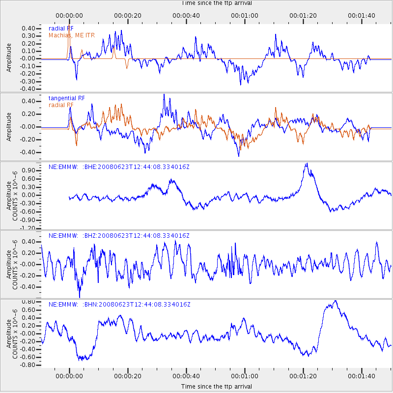
Signal To Noise
| Channel | StoN | STA | LTA |
| NE:EMMW: :BHZ:20080623T12:44:08.334016Z | 1.6771256 | 2.6132363E-7 | 1.5581638E-7 |
| NE:EMMW: :BHN:20080623T12:44:08.334016Z | 3.9699244 | 4.1288632E-7 | 1.0400357E-7 |
| NE:EMMW: :BHE:20080623T12:44:08.334016Z | 4.4368744 | 2.7400853E-7 | 6.1757106E-8 |
| Arrivals |
| Ps | |
| PpPs | |
| PsPs/PpSs | |


