You are here: Home > Network List > NE - New England Seismic Network Stations List
> Station PQI Presque Isle, ME > Earthquake Result Viewer
PQI Presque Isle, ME - Earthquake Result Viewer
*The percent match for this event was below the threshold and hence no stack was calculated.
| Earthquake location: |
Near Coast Of Northern Peru |
| Earthquake latitude/longitude: |
-5.7/-81.3 |
| Earthquake time(UTC): |
2009/03/26 (085) 17:35:14 GMT |
| Earthquake Depth: |
10 km |
| Earthquake Magnitude: |
5.6 MB, 5.5 MS, 5.8 MW, 5.7 MW |
| Earthquake Catalog/Contributor: |
WHDF/NEIC |
|
| Network: |
NE New England Seismic Network |
| Station: |
PQI Presque Isle, ME |
| Lat/Lon: |
46.67 N/68.01 W |
| Elevation: |
175 m |
|
| Distance: |
53.5 deg |
| Az: |
11.389 deg |
| Baz: |
196.58 deg |
| Ray Param: |
$rayparam |
*The percent match for this event was below the threshold and hence was not used in the summary stack. |
|
| Radial Match: |
57.837353 % |
| Radial Bump: |
400 |
| Transverse Match: |
51.77759 % |
| Transverse Bump: |
400 |
| SOD ConfigId: |
2658 |
| Insert Time: |
2010-03-09 20:24:35.880 +0000 |
| GWidth: |
2.5 |
| Max Bumps: |
400 |
| Tol: |
0.001 |
|
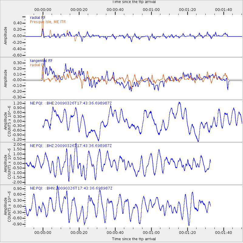
Signal To Noise
| Channel | StoN | STA | LTA |
| NE:PQI: :BHZ:20090326T17:43:36.698987Z | 1.0752528 | 6.200452E-7 | 5.766507E-7 |
| NE:PQI: :BHN:20090326T17:43:36.698987Z | 0.73926604 | 3.117394E-7 | 4.2168773E-7 |
| NE:PQI: :BHE:20090326T17:43:36.698987Z | 1.0767378 | 5.7318266E-7 | 5.3233265E-7 |
| Arrivals |
| Ps | |
| PpPs | |
| PsPs/PpSs | |


