You are here: Home > Network List > NE - New England Seismic Network Stations List
> Station PQI Presque Isle, ME > Earthquake Result Viewer
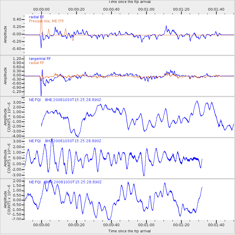
PQI Presque Isle, ME - Earthquake Result Viewer
*The percent match for this event was below the threshold and hence no stack was calculated.
| Earthquake location: |
Central East Pacific Rise |
| Earthquake latitude/longitude: |
-9.0/-108.2 |
| Earthquake time(UTC): |
2008/10/30 (304) 15:15:41 GMT |
| Earthquake Depth: |
10 km |
| Earthquake Magnitude: |
5.5 MB, 5.8 MS, 6.0 MW, 6.0 MW |
| Earthquake Catalog/Contributor: |
WHDF/NEIC |
|
| Network: |
NE New England Seismic Network |
| Station: |
PQI Presque Isle, ME |
| Lat/Lon: |
46.67 N/68.01 W |
| Elevation: |
175 m |
|
| Distance: |
66.0 deg |
| Az: |
29.13 deg |
| Baz: |
224.288 deg |
| Ray Param: |
$rayparam |
*The percent match for this event was below the threshold and hence was not used in the summary stack. |
|
| Radial Match: |
43.526432 % |
| Radial Bump: |
400 |
| Transverse Match: |
41.386642 % |
| Transverse Bump: |
400 |
| SOD ConfigId: |
2560 |
| Insert Time: |
2010-03-09 20:25:14.185 +0000 |
| GWidth: |
2.5 |
| Max Bumps: |
400 |
| Tol: |
0.001 |
|
Signal To Noise
| Channel | StoN | STA | LTA |
| NE:PQI: :BHZ:20081030T15:25:28.890Z | 1.7625463 | 1.5214133E-6 | 8.6319056E-7 |
| NE:PQI: :BHN:20081030T15:25:28.890Z | 2.782272 | 1.924792E-6 | 6.9180584E-7 |
| NE:PQI: :BHE:20081030T15:25:28.890Z | 2.2096584 | 2.7321637E-6 | 1.2364643E-6 |
| Arrivals |
| Ps | |
| PpPs | |
| PsPs/PpSs | |


