You are here: Home > Network List > NE - New England Seismic Network Stations List
> Station PQI Presque Isle, ME > Earthquake Result Viewer
PQI Presque Isle, ME - Earthquake Result Viewer
*The percent match for this event was below the threshold and hence no stack was calculated.
| Earthquake location: |
Central Mid-Atlantic Ridge |
| Earthquake latitude/longitude: |
8.1/-38.7 |
| Earthquake time(UTC): |
2008/09/10 (254) 13:08:14 GMT |
| Earthquake Depth: |
10 km |
| Earthquake Magnitude: |
6.3 MB, 6.5 MS, 6.6 MW, 6.6 MW |
| Earthquake Catalog/Contributor: |
WHDF/NEIC |
|
| Network: |
NE New England Seismic Network |
| Station: |
PQI Presque Isle, ME |
| Lat/Lon: |
46.67 N/68.01 W |
| Elevation: |
175 m |
|
| Distance: |
45.9 deg |
| Az: |
332.011 deg |
| Baz: |
137.56 deg |
| Ray Param: |
$rayparam |
*The percent match for this event was below the threshold and hence was not used in the summary stack. |
|
| Radial Match: |
42.373245 % |
| Radial Bump: |
400 |
| Transverse Match: |
56.47097 % |
| Transverse Bump: |
400 |
| SOD ConfigId: |
2560 |
| Insert Time: |
2010-03-09 20:25:24.387 +0000 |
| GWidth: |
2.5 |
| Max Bumps: |
400 |
| Tol: |
0.001 |
|
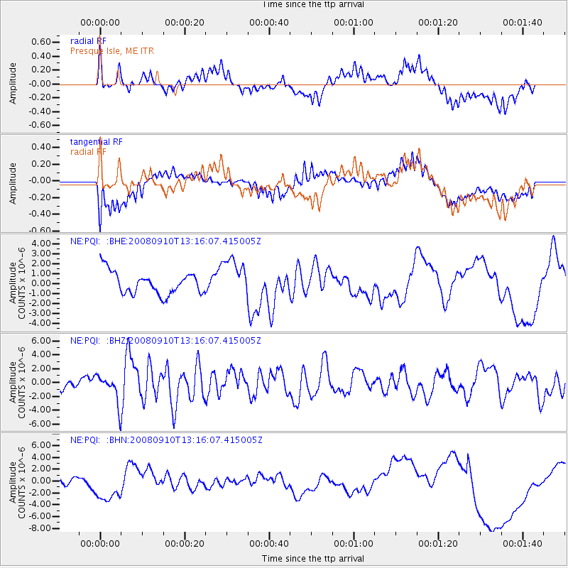
Signal To Noise
| Channel | StoN | STA | LTA |
| NE:PQI: :BHZ:20080910T13:16:07.415005Z | 4.6791744 | 2.0625919E-6 | 4.408025E-7 |
| NE:PQI: :BHN:20080910T13:16:07.415005Z | 1.8135003 | 2.4601707E-6 | 1.3565868E-6 |
| NE:PQI: :BHE:20080910T13:16:07.415005Z | 1.8347486 | 2.057703E-6 | 1.1215177E-6 |
| Arrivals |
| Ps | |
| PpPs | |
| PsPs/PpSs | |


