You are here: Home > Network List > US - United States National Seismic Network Stations List
> Station HAWA Hanford, Washington, USA > Earthquake Result Viewer
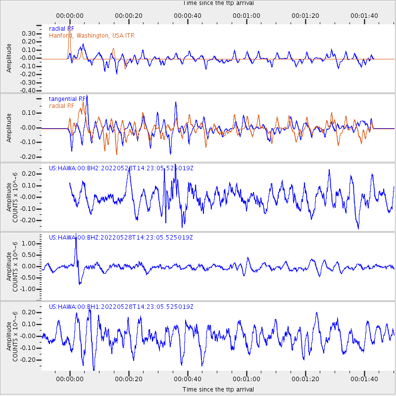
HAWA Hanford, Washington, USA - Earthquake Result Viewer
*The percent match for this event was below the threshold and hence no stack was calculated.
| Earthquake location: |
Santa Cruz Islands |
| Earthquake latitude/longitude: |
-12.2/167.1 |
| Earthquake time(UTC): |
2022/05/28 (148) 14:11:12 GMT |
| Earthquake Depth: |
214 km |
| Earthquake Magnitude: |
5.6 Mww |
| Earthquake Catalog/Contributor: |
NEIC PDE/us |
|
| Network: |
US United States National Seismic Network |
| Station: |
HAWA Hanford, Washington, USA |
| Lat/Lon: |
46.39 N/119.53 W |
| Elevation: |
364 m |
|
| Distance: |
87.6 deg |
| Az: |
41.598 deg |
| Baz: |
249.669 deg |
| Ray Param: |
$rayparam |
*The percent match for this event was below the threshold and hence was not used in the summary stack. |
|
| Radial Match: |
60.24071 % |
| Radial Bump: |
390 |
| Transverse Match: |
59.57923 % |
| Transverse Bump: |
390 |
| SOD ConfigId: |
27527651 |
| Insert Time: |
2022-06-11 14:33:33.885 +0000 |
| GWidth: |
2.5 |
| Max Bumps: |
400 |
| Tol: |
0.001 |
|
Signal To Noise
| Channel | StoN | STA | LTA |
| US:HAWA:00:BHZ:20220528T14:23:05.525019Z | 4.900242 | 4.8806896E-7 | 9.960099E-8 |
| US:HAWA:00:BH1:20220528T14:23:05.525019Z | 1.9112172 | 1.1980643E-7 | 6.268593E-8 |
| US:HAWA:00:BH2:20220528T14:23:05.525019Z | 1.2702818 | 1.0212626E-7 | 8.039654E-8 |
| Arrivals |
| Ps | |
| PpPs | |
| PsPs/PpSs | |


