You are here: Home > Network List > G - GEOSCOPE Stations List
> Station MPG Montagne des Peres, French Guyana > Earthquake Result Viewer
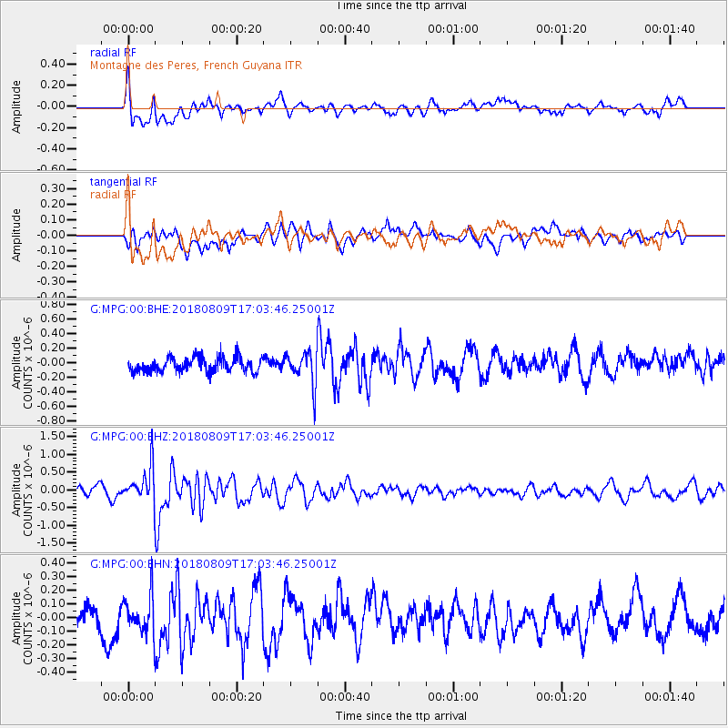
MPG Montagne des Peres, French Guyana - Earthquake Result Viewer
*The percent match for this event was below the threshold and hence no stack was calculated.
| Earthquake location: |
South Atlantic Ocean |
| Earthquake latitude/longitude: |
-33.4/2.5 |
| Earthquake time(UTC): |
2018/08/09 (221) 16:53:39 GMT |
| Earthquake Depth: |
10 km |
| Earthquake Magnitude: |
5.6 Mww |
| Earthquake Catalog/Contributor: |
NEIC PDE/us |
|
| Network: |
G GEOSCOPE |
| Station: |
MPG Montagne des Peres, French Guyana |
| Lat/Lon: |
5.11 N/52.64 W |
| Elevation: |
147 m |
|
| Distance: |
64.7 deg |
| Az: |
295.266 deg |
| Baz: |
130.57 deg |
| Ray Param: |
$rayparam |
*The percent match for this event was below the threshold and hence was not used in the summary stack. |
|
| Radial Match: |
63.600216 % |
| Radial Bump: |
400 |
| Transverse Match: |
62.429474 % |
| Transverse Bump: |
400 |
| SOD ConfigId: |
2778632 |
| Insert Time: |
2018-08-23 16:59:43.263 +0000 |
| GWidth: |
2.5 |
| Max Bumps: |
400 |
| Tol: |
0.001 |
|
Signal To Noise
| Channel | StoN | STA | LTA |
| G:MPG:00:BHZ:20180809T17:03:46.25001Z | 3.2220452 | 4.9106785E-7 | 1.5240873E-7 |
| G:MPG:00:BHN:20180809T17:03:46.25001Z | 1.3957071 | 1.4788316E-7 | 1.0595572E-7 |
| G:MPG:00:BHE:20180809T17:03:46.25001Z | 2.3326828 | 2.294511E-7 | 9.8363614E-8 |
| Arrivals |
| Ps | |
| PpPs | |
| PsPs/PpSs | |


