NM18 NewMexico18 - Earthquake Result Viewer
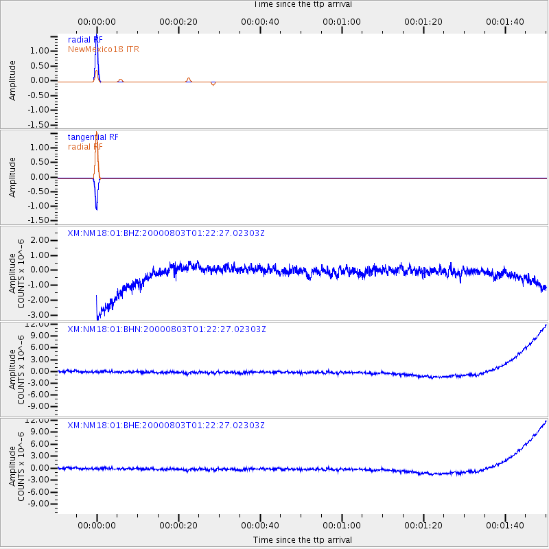
Earthquake location: Santa Cruz Islands
Earthquake latitude/longitude: -12.0/166.4
Earthquake time(UTC): 2000/08/03 (216) 01:09:38 GMT
Earthquake Depth: 33 km
Earthquake Magnitude: 5.7 MB, 6.5 MS, 6.7 MW, 6.6 MW
Earthquake Catalog/Contributor: WHDF/NEIC
Network: XM Rio Grande Seismic Transect
Station: NM18 NewMexico18
Lat/Lon: 33.40 N/105.34 W
Elevation: 1624 m
Distance: 95.0 deg
Az: 57.073 deg
Baz: 259.0 deg
Ray Param: 0.04087141
Estimated Moho Depth: 10.0 km
Estimated Crust Vp/Vs: 1.60
Assumed Crust Vp: 6.232 km/s
Estimated Crust Vs: 3.895 km/s
Estimated Crust Poisson's Ratio: 0.18
Radial Match: 99.999985 %
Radial Bump: 2
Transverse Match: 99.999985 %
Transverse Bump: 2
SOD ConfigId: 16820
Insert Time: 2010-02-26 17:26:47.873 +0000
GWidth: 2.5
Max Bumps: 400
Tol: 0.001

Signal To Noise

ChannelStoNSTALTA
XM:NM18:01:BHN:20000803T01:22:27.02303Z0.88488298.939601E-71.0102581E-6
XM:NM18:01:BHE:20000803T01:22:27.02303Z0.887616348.961118E-71.0095712E-6
XM:NM18:01:BHZ:20000803T01:22:27.02303Z0.88626429.2052795E-71.0386609E-6
Arrivals
Ps1.0 SECOND
PpPs4.1 SECOND
PsPs/PpSs5.1 SECOND