You are here: Home > Network List > IU - Global Seismograph Network (GSN - IRIS/USGS) Stations List
> Station RSSD Black Hills, South Dakota, USA > Earthquake Result Viewer
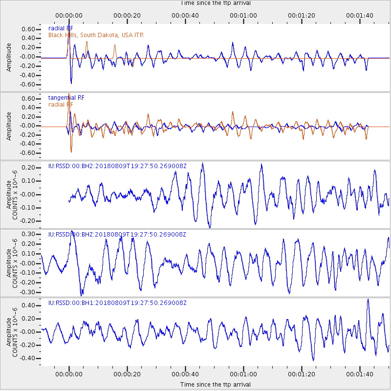
RSSD Black Hills, South Dakota, USA - Earthquake Result Viewer
*The percent match for this event was below the threshold and hence no stack was calculated.
| Earthquake location: |
Near Coast Of Guatemala |
| Earthquake latitude/longitude: |
13.6/-91.2 |
| Earthquake time(UTC): |
2018/08/09 (221) 19:21:53 GMT |
| Earthquake Depth: |
29 km |
| Earthquake Magnitude: |
5.6 Mww |
| Earthquake Catalog/Contributor: |
NEIC PDE/us |
|
| Network: |
IU Global Seismograph Network (GSN - IRIS/USGS) |
| Station: |
RSSD Black Hills, South Dakota, USA |
| Lat/Lon: |
44.12 N/104.04 W |
| Elevation: |
2090 m |
|
| Distance: |
32.4 deg |
| Az: |
342.587 deg |
| Baz: |
156.167 deg |
| Ray Param: |
$rayparam |
*The percent match for this event was below the threshold and hence was not used in the summary stack. |
|
| Radial Match: |
68.14338 % |
| Radial Bump: |
400 |
| Transverse Match: |
41.97485 % |
| Transverse Bump: |
400 |
| SOD ConfigId: |
2778632 |
| Insert Time: |
2018-08-23 19:23:52.265 +0000 |
| GWidth: |
2.5 |
| Max Bumps: |
400 |
| Tol: |
0.001 |
|
Signal To Noise
| Channel | StoN | STA | LTA |
| IU:RSSD:00:BHZ:20180809T19:27:50.269008Z | 3.4893453 | 2.2066574E-7 | 6.323987E-8 |
| IU:RSSD:00:BH1:20180809T19:27:50.269008Z | 1.1478267 | 8.484736E-8 | 7.3920006E-8 |
| IU:RSSD:00:BH2:20180809T19:27:50.269008Z | 1.7294946 | 5.772361E-8 | 3.3376E-8 |
| Arrivals |
| Ps | |
| PpPs | |
| PsPs/PpSs | |


