You are here: Home > Network List > US - United States National Seismic Network Stations List
> Station DGMT Dagmar, Montana, USA > Earthquake Result Viewer
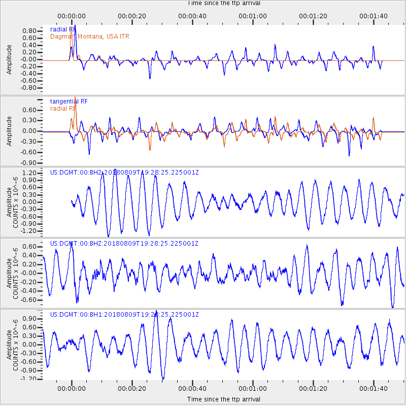
DGMT Dagmar, Montana, USA - Earthquake Result Viewer
*The percent match for this event was below the threshold and hence no stack was calculated.
| Earthquake location: |
Near Coast Of Guatemala |
| Earthquake latitude/longitude: |
13.6/-91.2 |
| Earthquake time(UTC): |
2018/08/09 (221) 19:21:53 GMT |
| Earthquake Depth: |
29 km |
| Earthquake Magnitude: |
5.6 Mww |
| Earthquake Catalog/Contributor: |
NEIC PDE/us |
|
| Network: |
US United States National Seismic Network |
| Station: |
DGMT Dagmar, Montana, USA |
| Lat/Lon: |
48.47 N/104.20 W |
| Elevation: |
0.0 m |
|
| Distance: |
36.4 deg |
| Az: |
345.382 deg |
| Baz: |
158.36 deg |
| Ray Param: |
$rayparam |
*The percent match for this event was below the threshold and hence was not used in the summary stack. |
|
| Radial Match: |
78.04636 % |
| Radial Bump: |
301 |
| Transverse Match: |
60.51694 % |
| Transverse Bump: |
256 |
| SOD ConfigId: |
2778632 |
| Insert Time: |
2018-08-23 19:25:05.975 +0000 |
| GWidth: |
2.5 |
| Max Bumps: |
400 |
| Tol: |
0.001 |
|
Signal To Noise
| Channel | StoN | STA | LTA |
| US:DGMT:00:BHZ:20180809T19:28:25.225001Z | 1.9242204 | 3.9364508E-7 | 2.045738E-7 |
| US:DGMT:00:BH1:20180809T19:28:25.225001Z | 0.57588506 | 1.7532646E-7 | 3.0444696E-7 |
| US:DGMT:00:BH2:20180809T19:28:25.225001Z | 0.8266963 | 6.1661854E-7 | 7.4588286E-7 |
| Arrivals |
| Ps | |
| PpPs | |
| PsPs/PpSs | |


