You are here: Home > Network List > IW - Intermountain West Stations List
> Station MOOW Moose Ponds, Wyoming, USA > Earthquake Result Viewer
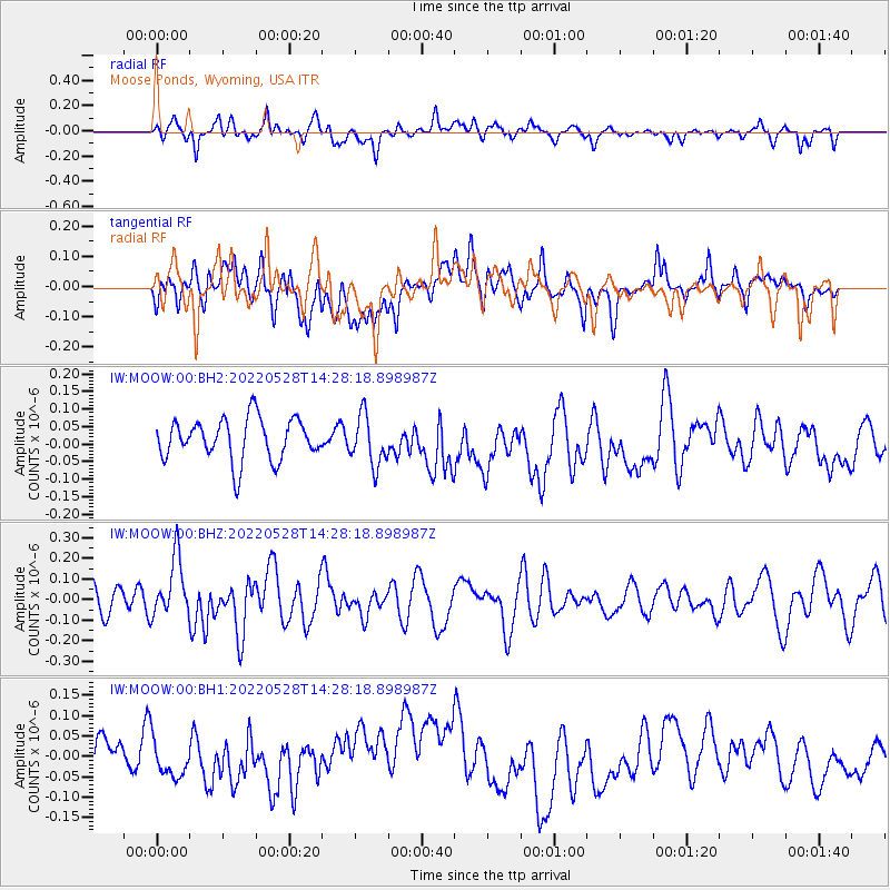
MOOW Moose Ponds, Wyoming, USA - Earthquake Result Viewer
*The percent match for this event was below the threshold and hence no stack was calculated.
| Earthquake location: |
Northern Mid-Atlantic Ridge |
| Earthquake latitude/longitude: |
23.4/-45.0 |
| Earthquake time(UTC): |
2022/05/28 (148) 14:19:05 GMT |
| Earthquake Depth: |
10 km |
| Earthquake Magnitude: |
5.7 mww |
| Earthquake Catalog/Contributor: |
NEIC PDE/us |
|
| Network: |
IW Intermountain West |
| Station: |
MOOW Moose Ponds, Wyoming, USA |
| Lat/Lon: |
43.75 N/110.74 W |
| Elevation: |
2128 m |
|
| Distance: |
56.9 deg |
| Az: |
307.936 deg |
| Baz: |
88.197 deg |
| Ray Param: |
$rayparam |
*The percent match for this event was below the threshold and hence was not used in the summary stack. |
|
| Radial Match: |
56.1394 % |
| Radial Bump: |
400 |
| Transverse Match: |
46.925896 % |
| Transverse Bump: |
400 |
| SOD ConfigId: |
27527651 |
| Insert Time: |
2022-06-11 14:54:09.519 +0000 |
| GWidth: |
2.5 |
| Max Bumps: |
400 |
| Tol: |
0.001 |
|
Signal To Noise
| Channel | StoN | STA | LTA |
| IW:MOOW:00:BHZ:20220528T14:28:18.898987Z | 1.7894611 | 1.4336455E-7 | 8.0116045E-8 |
| IW:MOOW:00:BH1:20220528T14:28:18.898987Z | 0.8918731 | 4.2124046E-8 | 4.7230987E-8 |
| IW:MOOW:00:BH2:20220528T14:28:18.898987Z | 1.2100066 | 7.1377066E-8 | 5.898899E-8 |
| Arrivals |
| Ps | |
| PpPs | |
| PsPs/PpSs | |


