You are here: Home > Network List > US - United States National Seismic Network Stations List
> Station MSO Missoula, Montana, USA > Earthquake Result Viewer
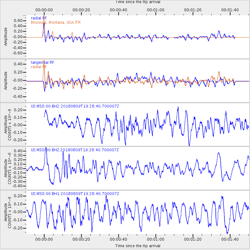
MSO Missoula, Montana, USA - Earthquake Result Viewer
*The percent match for this event was below the threshold and hence no stack was calculated.
| Earthquake location: |
Near Coast Of Guatemala |
| Earthquake latitude/longitude: |
13.6/-91.2 |
| Earthquake time(UTC): |
2018/08/09 (221) 19:21:53 GMT |
| Earthquake Depth: |
29 km |
| Earthquake Magnitude: |
5.6 Mww |
| Earthquake Catalog/Contributor: |
NEIC PDE/us |
|
| Network: |
US United States National Seismic Network |
| Station: |
MSO Missoula, Montana, USA |
| Lat/Lon: |
46.83 N/113.94 W |
| Elevation: |
1264 m |
|
| Distance: |
38.3 deg |
| Az: |
334.597 deg |
| Baz: |
142.587 deg |
| Ray Param: |
$rayparam |
*The percent match for this event was below the threshold and hence was not used in the summary stack. |
|
| Radial Match: |
48.830387 % |
| Radial Bump: |
400 |
| Transverse Match: |
53.781563 % |
| Transverse Bump: |
400 |
| SOD ConfigId: |
2778632 |
| Insert Time: |
2018-08-23 19:25:28.261 +0000 |
| GWidth: |
2.5 |
| Max Bumps: |
400 |
| Tol: |
0.001 |
|
Signal To Noise
| Channel | StoN | STA | LTA |
| US:MSO:00:BHZ:20180809T19:28:40.700007Z | 3.7194536 | 2.6381775E-7 | 7.092917E-8 |
| US:MSO:00:BH1:20180809T19:28:40.700007Z | 1.8739542 | 1.06995365E-7 | 5.709604E-8 |
| US:MSO:00:BH2:20180809T19:28:40.700007Z | 1.8178416 | 1.2766832E-7 | 7.023071E-8 |
| Arrivals |
| Ps | |
| PpPs | |
| PsPs/PpSs | |


