
NM18 NewMexico18 - Earthquake Result Viewer
| ||||||||||||||||||
| ||||||||||||||||||
| ||||||||||||||||||
|
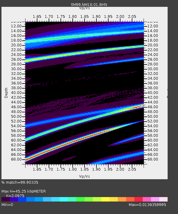
Signal To Noise
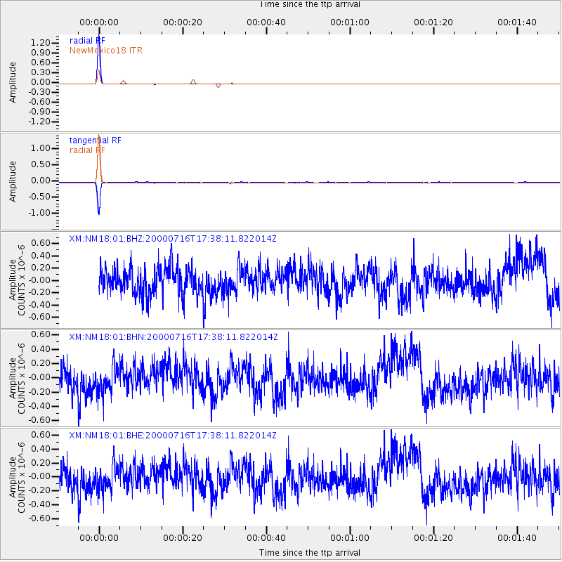
| Channel | StoN | STA | LTA |
| XM:NM18:01:BHN:20000716T17:38:11.822014Z | 0.9715967 | 1.894622E-7 | 1.9500087E-7 |
| XM:NM18:01:BHE:20000716T17:38:11.822014Z | 0.91526353 | 1.7842031E-7 | 1.9493874E-7 |
| XM:NM18:01:BHZ:20000716T17:38:11.822014Z | 0.9168835 | 1.9944696E-7 | 2.1752703E-7 |
| Arrivals | |
| Ps | 8.1 SECOND |
| PpPs | 22 SECOND |
| PsPs/PpSs | 30 SECOND |

