
NM18 NewMexico18 - Earthquake Result Viewer
| ||||||||||||||||||
| ||||||||||||||||||
| ||||||||||||||||||
|
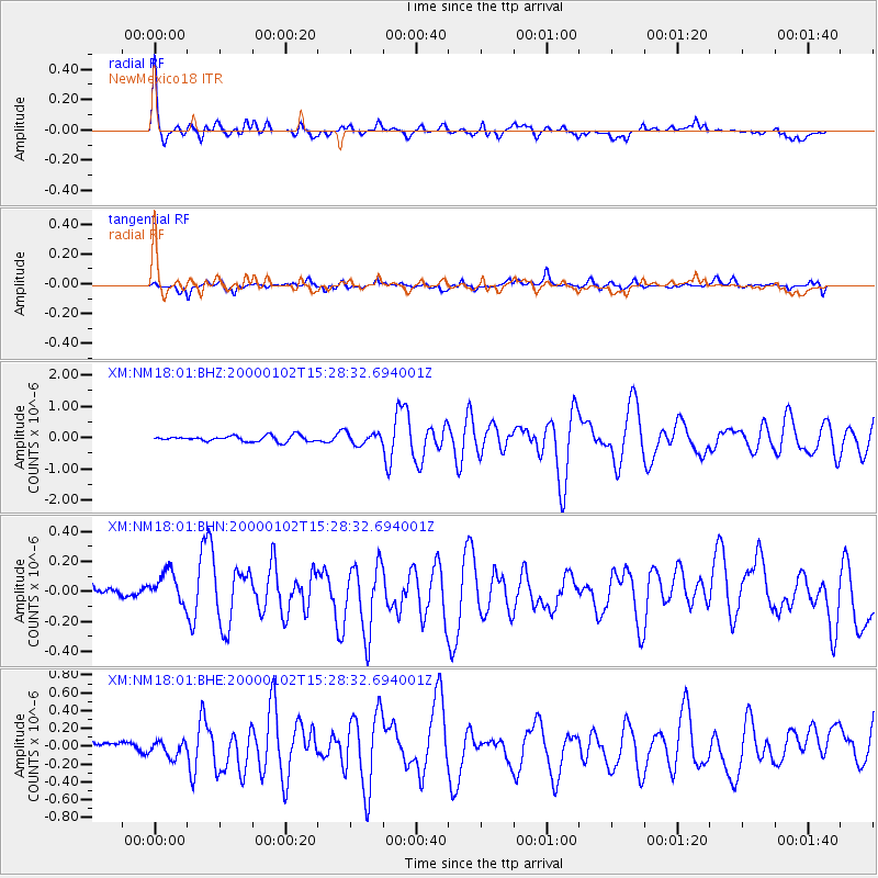
Signal To Noise
| Channel | StoN | STA | LTA |
| XM:NM18:01:BHN:20000102T15:28:32.694001Z | 1.2489241 | 1.1690751E-7 | 9.360657E-8 |
| XM:NM18:01:BHE:20000102T15:28:32.694001Z | 0.5941467 | 8.380957E-8 | 1.410587E-7 |
| XM:NM18:01:BHZ:20000102T15:28:32.694001Z | 1.9935573 | 1.8194801E-7 | 9.1268014E-8 |
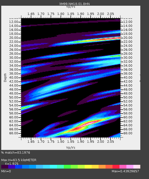
| Arrivals | |
| Ps | 9.6 SECOND |
| PpPs | 29 SECOND |
| PsPs/PpSs | 39 SECOND |

