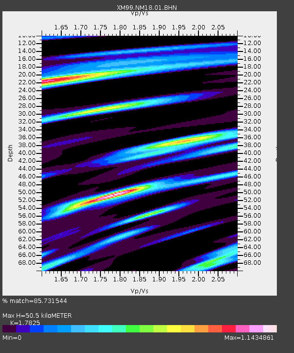
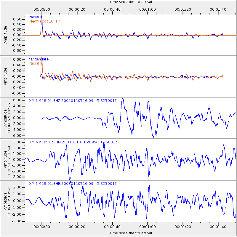
NM18 NewMexico18 - Earthquake Result Viewer

Earthquake location: Kodiak Island Region, Alaska
Earthquake latitude/longitude: 57.1/-153.2
Earthquake time(UTC): 2001/01/10 (010) 16:02:44 GMT
Earthquake Depth: 33 km
Earthquake Magnitude: 6.2 MB, 6.8 MS, 7.1 MW, 6.8 ML
Earthquake Catalog/Contributor: WHDF/NEIC
Network: XM Rio Grande Seismic Transect
Station: NM18 NewMexico18
Lat/Lon: 33.40 N/105.34 W
Elevation: 1624 m
Distance: 40.1 deg
Az: 105.4 deg
Baz: 320.997 deg
Ray Param: 0.07455114
Estimated Moho Depth: 50.5 km
Estimated Crust Vp/Vs: 1.78
Assumed Crust Vp: 6.232 km/s
Estimated Crust Vs: 3.496 km/s
Estimated Crust Poisson's Ratio: 0.27
Radial Match: 85.731544 %
Radial Bump: 400
Transverse Match: 71.206825 %
Transverse Bump: 400
SOD ConfigId: 3744
Insert Time: 2010-02-26 17:27:06.012 +0000
GWidth: 2.5
Max Bumps: 400
Tol: 0.001

Signal To Noise

ChannelStoNSTALTA
XM:NM18:01:BHN:20010110T16:09:45.825001Z1.61675954.111739E-72.5431976E-7
XM:NM18:01:BHE:20010110T16:09:45.825001Z1.12161423.6741545E-73.275774E-7
XM:NM18:01:BHZ:20010110T16:09:45.825001Z2.24586777.818289E-73.4811885E-7
Arrivals
Ps6.8 SECOND
PpPs21 SECOND
PsPs/PpSs28 SECOND