You are here: Home > Network List > GS - US Geological Survey Networks Stations List
> Station OK051 E0350 and S34600 Roads, Ralston, OK > Earthquake Result Viewer
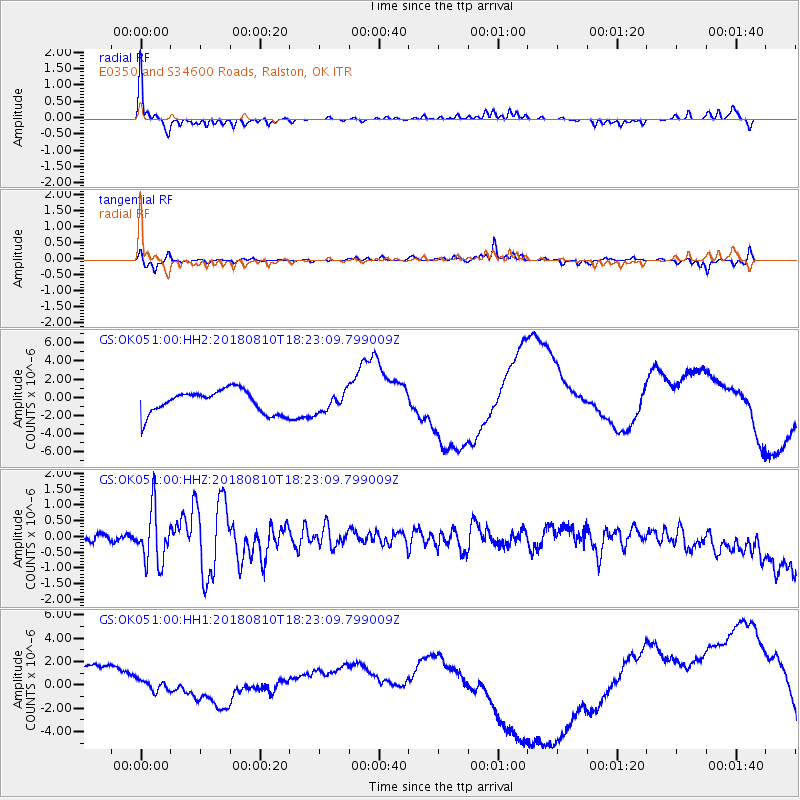
OK051 E0350 and S34600 Roads, Ralston, OK - Earthquake Result Viewer
*The percent match for this event was below the threshold and hence no stack was calculated.
| Earthquake location: |
Kuril Islands |
| Earthquake latitude/longitude: |
48.5/154.8 |
| Earthquake time(UTC): |
2018/08/10 (222) 18:12:05 GMT |
| Earthquake Depth: |
16 km |
| Earthquake Magnitude: |
5.9 Mww |
| Earthquake Catalog/Contributor: |
NEIC PDE/us |
|
| Network: |
GS US Geological Survey Networks |
| Station: |
OK051 E0350 and S34600 Roads, Ralston, OK |
| Lat/Lon: |
36.51 N/96.84 W |
| Elevation: |
263 m |
|
| Distance: |
74.2 deg |
| Az: |
52.63 deg |
| Baz: |
318.971 deg |
| Ray Param: |
$rayparam |
*The percent match for this event was below the threshold and hence was not used in the summary stack. |
|
| Radial Match: |
40.75756 % |
| Radial Bump: |
216 |
| Transverse Match: |
17.41353 % |
| Transverse Bump: |
179 |
| SOD ConfigId: |
2778632 |
| Insert Time: |
2018-08-24 18:15:54.228 +0000 |
| GWidth: |
2.5 |
| Max Bumps: |
400 |
| Tol: |
0.001 |
|
Signal To Noise
| Channel | StoN | STA | LTA |
| GS:OK051:00:HHZ:20180810T18:23:09.799009Z | 6.019566 | 8.391107E-7 | 1.3939722E-7 |
| GS:OK051:00:HH1:20180810T18:23:09.799009Z | 0.49370342 | 1.2525315E-6 | 2.537012E-6 |
| GS:OK051:00:HH2:20180810T18:23:09.799009Z | 0.79425204 | 1.0305432E-6 | 1.2975015E-6 |
| Arrivals |
| Ps | |
| PpPs | |
| PsPs/PpSs | |


