You are here: Home > Network List > IU - Global Seismograph Network (GSN - IRIS/USGS) Stations List
> Station PMG Port Moresby, New Guinea > Earthquake Result Viewer
PMG Port Moresby, New Guinea - Earthquake Result Viewer
*The percent match for this event was below the threshold and hence no stack was calculated.
| Earthquake location: |
Kuril Islands |
| Earthquake latitude/longitude: |
48.5/154.8 |
| Earthquake time(UTC): |
2018/08/10 (222) 18:12:05 GMT |
| Earthquake Depth: |
16 km |
| Earthquake Magnitude: |
5.9 Mww |
| Earthquake Catalog/Contributor: |
NEIC PDE/us |
|
| Network: |
IU Global Seismograph Network (GSN - IRIS/USGS) |
| Station: |
PMG Port Moresby, New Guinea |
| Lat/Lon: |
9.40 S/147.16 E |
| Elevation: |
90 m |
|
| Distance: |
58.0 deg |
| Az: |
188.866 deg |
| Baz: |
5.967 deg |
| Ray Param: |
$rayparam |
*The percent match for this event was below the threshold and hence was not used in the summary stack. |
|
| Radial Match: |
70.08393 % |
| Radial Bump: |
400 |
| Transverse Match: |
60.192913 % |
| Transverse Bump: |
400 |
| SOD ConfigId: |
2778632 |
| Insert Time: |
2018-08-24 18:16:45.457 +0000 |
| GWidth: |
2.5 |
| Max Bumps: |
400 |
| Tol: |
0.001 |
|
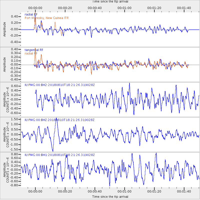
Signal To Noise
| Channel | StoN | STA | LTA |
| IU:PMG:00:BHZ:20180810T18:21:26.319028Z | 2.3448439 | 5.0348547E-7 | 2.1472023E-7 |
| IU:PMG:00:BH1:20180810T18:21:26.319028Z | 1.320982 | 2.6406437E-7 | 1.9990006E-7 |
| IU:PMG:00:BH2:20180810T18:21:26.319028Z | 0.90156335 | 1.8183046E-7 | 2.016835E-7 |
| Arrivals |
| Ps | |
| PpPs | |
| PsPs/PpSs | |


