UT51 Utah51 - Earthquake Result Viewer
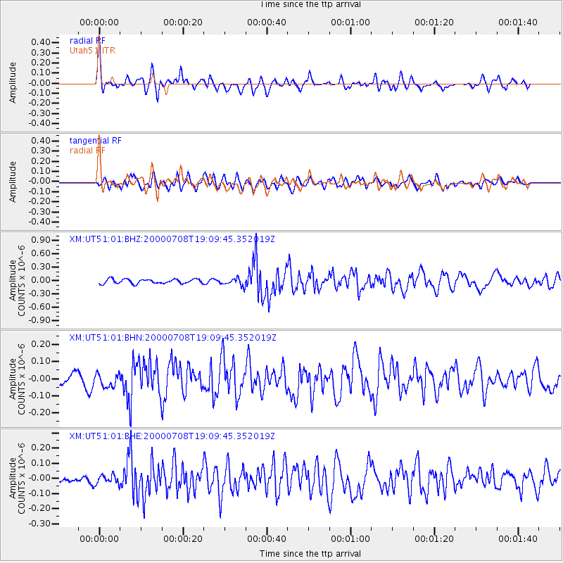
Earthquake location: Near S. Coast Of Honshu, Japan
Earthquake latitude/longitude: 34.1/139.1
Earthquake time(UTC): 2000/07/08 (190) 18:57:44 GMT
Earthquake Depth: 10 km
Earthquake Magnitude: 5.9 MB, 5.6 MS, 6.0 MW, 5.9 MW
Earthquake Catalog/Contributor: WHDF/NEIC
Network: XM Rio Grande Seismic Transect
Station: UT51 Utah51
Lat/Lon: 37.07 N/110.00 W
Elevation: 1498 m
Distance: 84.4 deg
Az: 48.669 deg
Baz: 308.786 deg
Ray Param: 0.04552435
Estimated Moho Depth: 43.5 km
Estimated Crust Vp/Vs: 1.95
Assumed Crust Vp: 6.476 km/s
Estimated Crust Vs: 3.321 km/s
Estimated Crust Poisson's Ratio: 0.32
Radial Match: 81.27864 %
Radial Bump: 400
Transverse Match: 75.356445 %
Transverse Bump: 400
SOD ConfigId: 27569
Insert Time: 2010-02-26 17:27:31.912 +0000
GWidth: 2.5
Max Bumps: 400
Tol: 0.001

Signal To Noise

ChannelStoNSTALTA
XM:UT51:01:BHN:20000708T19:09:45.352019Z1.18953043.930136E-83.303939E-8
XM:UT51:01:BHE:20000708T19:09:45.352019Z1.0858472.8782496E-82.6506955E-8
XM:UT51:01:BHZ:20000708T19:09:45.352019Z1.70273518.295019E-84.8715847E-8
Arrivals
Ps6.5 SECOND
PpPs19 SECOND
PsPs/PpSs26 SECOND