You are here: Home > Network List > US - United States National Seismic Network Stations List
> Station AMTX Amarillo, Texas, USA > Earthquake Result Viewer
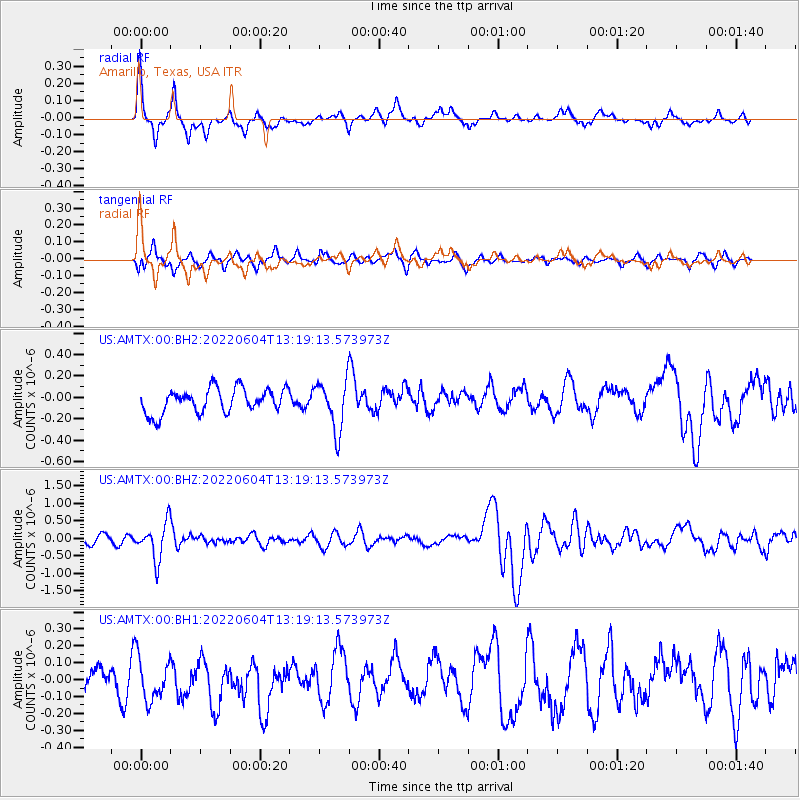
AMTX Amarillo, Texas, USA - Earthquake Result Viewer
*The percent match for this event was below the threshold and hence no stack was calculated.
| Earthquake location: |
Tonga Islands |
| Earthquake latitude/longitude: |
-18.0/-175.0 |
| Earthquake time(UTC): |
2022/06/04 (155) 13:07:25 GMT |
| Earthquake Depth: |
237 km |
| Earthquake Magnitude: |
6.3 mww |
| Earthquake Catalog/Contributor: |
NEIC PDE/us |
|
| Network: |
US United States National Seismic Network |
| Station: |
AMTX Amarillo, Texas, USA |
| Lat/Lon: |
34.53 N/101.41 W |
| Elevation: |
1010 m |
|
| Distance: |
87.2 deg |
| Az: |
52.449 deg |
| Baz: |
246.07 deg |
| Ray Param: |
$rayparam |
*The percent match for this event was below the threshold and hence was not used in the summary stack. |
|
| Radial Match: |
76.746254 % |
| Radial Bump: |
369 |
| Transverse Match: |
57.348812 % |
| Transverse Bump: |
400 |
| SOD ConfigId: |
28208852 |
| Insert Time: |
2022-06-27 15:40:25.054 +0000 |
| GWidth: |
2.5 |
| Max Bumps: |
400 |
| Tol: |
0.001 |
|
Signal To Noise
| Channel | StoN | STA | LTA |
| US:AMTX:00:BHZ:20220604T13:19:13.573973Z | 4.427633 | 5.216164E-7 | 1.1780933E-7 |
| US:AMTX:00:BH1:20220604T13:19:13.573973Z | 1.290415 | 1.2625846E-7 | 9.78433E-8 |
| US:AMTX:00:BH2:20220604T13:19:13.573973Z | 2.1578164 | 2.456492E-7 | 1.13841566E-7 |
| Arrivals |
| Ps | |
| PpPs | |
| PsPs/PpSs | |


