You are here: Home > Network List > CN - Canadian National Seismograph Network Stations List
> Station INK INUVIK, NT > Earthquake Result Viewer
INK INUVIK, NT - Earthquake Result Viewer
*The percent match for this event was below the threshold and hence no stack was calculated.
| Earthquake location: |
Minahassa Peninsula, Sulawesi |
| Earthquake latitude/longitude: |
0.1/123.7 |
| Earthquake time(UTC): |
2022/06/07 (158) 13:24:13 GMT |
| Earthquake Depth: |
132 km |
| Earthquake Magnitude: |
5.6 mww |
| Earthquake Catalog/Contributor: |
NEIC PDE/us |
|
| Network: |
CN Canadian National Seismograph Network |
| Station: |
INK INUVIK, NT |
| Lat/Lon: |
68.31 N/133.53 W |
| Elevation: |
44 m |
|
| Distance: |
94.6 deg |
| Az: |
21.328 deg |
| Baz: |
281.974 deg |
| Ray Param: |
$rayparam |
*The percent match for this event was below the threshold and hence was not used in the summary stack. |
|
| Radial Match: |
50.88809 % |
| Radial Bump: |
400 |
| Transverse Match: |
60.179375 % |
| Transverse Bump: |
400 |
| SOD ConfigId: |
28208852 |
| Insert Time: |
2022-06-27 16:53:20.585 +0000 |
| GWidth: |
2.5 |
| Max Bumps: |
400 |
| Tol: |
0.001 |
|
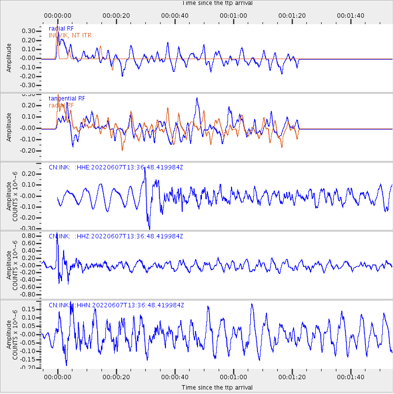
Signal To Noise
| Channel | StoN | STA | LTA |
| CN:INK: :HHZ:20220607T13:36:48.419984Z | 5.5456924 | 3.1752367E-7 | 5.7255907E-8 |
| CN:INK: :HHN:20220607T13:36:48.419984Z | 1.1458844 | 9.3102244E-8 | 8.124925E-8 |
| CN:INK: :HHE:20220607T13:36:48.419984Z | 2.4817462 | 1.5592644E-7 | 6.282933E-8 |
| Arrivals |
| Ps | |
| PpPs | |
| PsPs/PpSs | |


