You are here: Home > Network List > TX - Texas Seismological Network Stations List
> Station WTFS Witchita Falls > Earthquake Result Viewer
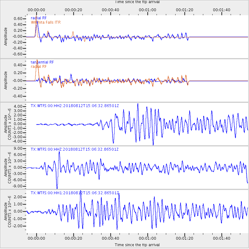
WTFS Witchita Falls - Earthquake Result Viewer
*The percent match for this event was below the threshold and hence no stack was calculated.
| Earthquake location: |
Northern Alaska |
| Earthquake latitude/longitude: |
69.6/-145.3 |
| Earthquake time(UTC): |
2018/08/12 (224) 14:58:54 GMT |
| Earthquake Depth: |
2.2 km |
| Earthquake Magnitude: |
6.3 ml |
| Earthquake Catalog/Contributor: |
NEIC PDE/ak |
|
| Network: |
TX Texas Seismological Network |
| Station: |
WTFS Witchita Falls |
| Lat/Lon: |
33.77 N/98.46 W |
| Elevation: |
277 m |
|
| Distance: |
44.1 deg |
| Az: |
119.175 deg |
| Baz: |
338.397 deg |
| Ray Param: |
$rayparam |
*The percent match for this event was below the threshold and hence was not used in the summary stack. |
|
| Radial Match: |
72.37264 % |
| Radial Bump: |
400 |
| Transverse Match: |
71.906235 % |
| Transverse Bump: |
400 |
| SOD ConfigId: |
2825771 |
| Insert Time: |
2018-08-26 15:07:08.602 +0000 |
| GWidth: |
2.5 |
| Max Bumps: |
400 |
| Tol: |
0.001 |
|
Signal To Noise
| Channel | StoN | STA | LTA |
| TX:WTFS:00:HHZ:20180812T15:06:32.86501Z | 8.987727 | 8.33973E-7 | 9.2790195E-8 |
| TX:WTFS:00:HH1:20180812T15:06:32.86501Z | 1.1176089 | 8.559446E-8 | 7.658713E-8 |
| TX:WTFS:00:HH2:20180812T15:06:32.86501Z | 2.9532177 | 2.84646E-7 | 9.638503E-8 |
| Arrivals |
| Ps | |
| PpPs | |
| PsPs/PpSs | |


