You are here: Home > Network List > G - GEOSCOPE Stations List
> Station MPG Montagne des Peres, French Guyana > Earthquake Result Viewer
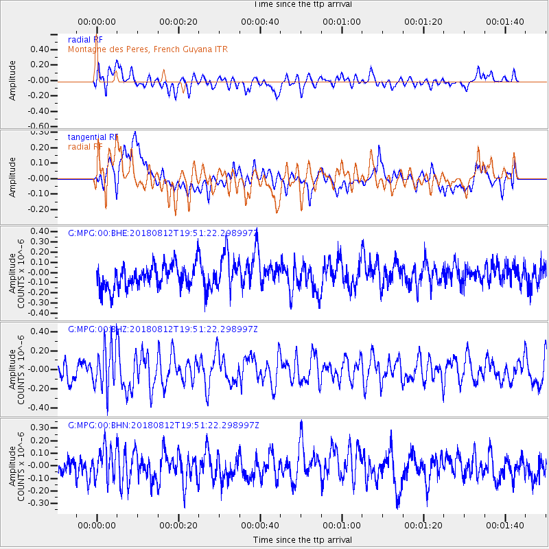
MPG Montagne des Peres, French Guyana - Earthquake Result Viewer
*The percent match for this event was below the threshold and hence no stack was calculated.
| Earthquake location: |
Southeast Of Easter Island |
| Earthquake latitude/longitude: |
-35.7/-102.4 |
| Earthquake time(UTC): |
2018/08/12 (224) 19:41:34 GMT |
| Earthquake Depth: |
10 km |
| Earthquake Magnitude: |
5.6 Mww |
| Earthquake Catalog/Contributor: |
NEIC PDE/us |
|
| Network: |
G GEOSCOPE |
| Station: |
MPG Montagne des Peres, French Guyana |
| Lat/Lon: |
5.11 N/52.64 W |
| Elevation: |
147 m |
|
| Distance: |
61.8 deg |
| Az: |
59.592 deg |
| Baz: |
224.816 deg |
| Ray Param: |
$rayparam |
*The percent match for this event was below the threshold and hence was not used in the summary stack. |
|
| Radial Match: |
54.456726 % |
| Radial Bump: |
400 |
| Transverse Match: |
46.041077 % |
| Transverse Bump: |
400 |
| SOD ConfigId: |
2825771 |
| Insert Time: |
2018-08-26 19:44:42.241 +0000 |
| GWidth: |
2.5 |
| Max Bumps: |
400 |
| Tol: |
0.001 |
|
Signal To Noise
| Channel | StoN | STA | LTA |
| G:MPG:00:BHZ:20180812T19:51:22.298997Z | 1.6945719 | 2.2984727E-7 | 1.3563736E-7 |
| G:MPG:00:BHN:20180812T19:51:22.298997Z | 1.2668098 | 1.2868277E-7 | 1.01580184E-7 |
| G:MPG:00:BHE:20180812T19:51:22.298997Z | 1.6389327 | 1.8166229E-7 | 1.10841825E-7 |
| Arrivals |
| Ps | |
| PpPs | |
| PsPs/PpSs | |


